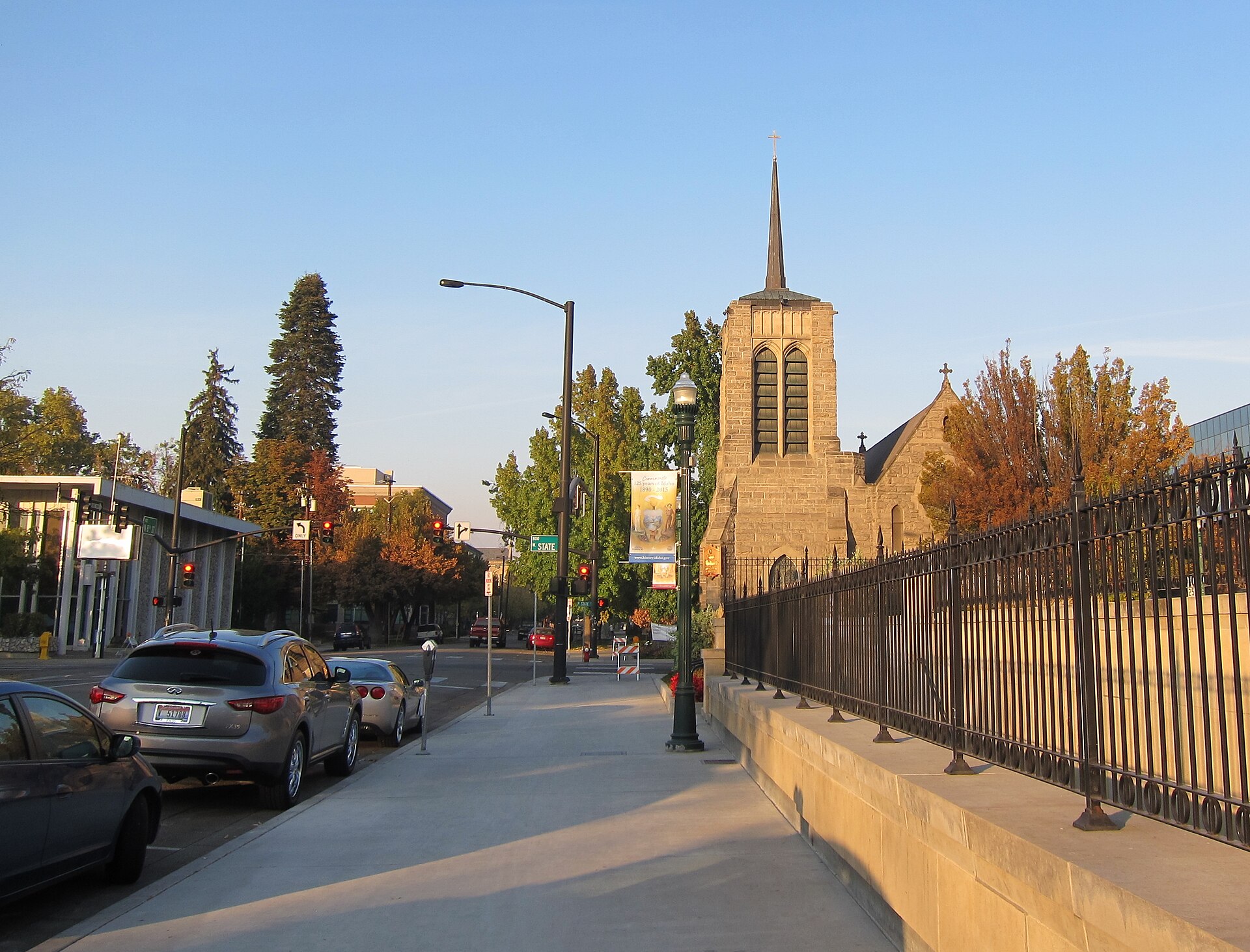
Boise is walkable in its center and in a handful of adjoining older neighborhoods, and not walkable across most of its metro area. Downtown, the Basque Block, the North End and the East End can be covered comfortably on foot. West Boise, most of the Bench, and the suburbs of Meridian and Eagle were built around cars and require driving or a bus.
What makes downtown Boise walkable?
Downtown Boise is compact, gridded, and dense with destinations within a few blocks of one another — government buildings, museums, theaters and the Grove Plaza sit inside an area small enough to cross end to end in under twenty minutes.
The core sits within the boundaries described in the city’s own planning documents, running roughly from the Boise River north to the edge of the North End, and from the Connector east to around the Old Boise district. Within that footprint, the Idaho State Capitol, the Ada County Courthouse, the Egyptian Theatre and the Grove Plaza are all a short walk from each other. For the exact edges of this area, see what counts as downtown Boise and where it begins and ends.
The one-way street pattern downtown is a legacy of mid-20th-century traffic planning rather than the original 19th-century grid, and it shapes how driving and walking feel different here — see why downtown Boise has so many one-way streets for how that system works. Because downtown is easy to cross on foot but was designed to move cars quickly along certain corridors, understanding how parking works downtown matters more for anyone arriving by car and switching to walking once parked.
Is the Basque Block walkable from downtown?
Yes. The Basque Block is a single short stretch of Grove Street inside the downtown core, reachable on foot from the Capitol, the Grove Plaza or the Boise Depot area in a matter of minutes.
The National Park Service and the Basque Museum and Cultural Center both describe the block as the center of Basque-American heritage in Boise, home to Basque cultural institutions, an ostatuak (a Basque boarding house/restaurant tradition) heritage, and the site of the biennial Jaialdi festival celebrations. Its scale — a single block — means it functions less as a district to wander and more as a fixed point easily folded into a downtown walk. Details on what the museum holds are covered separately at the Basque Museum and Cultural Center’s collection.
Are the North End and East End walkable neighborhoods?
Both are walkable in the sense that matters to residents: tree-lined grids, a commercial spine within walking distance of most homes, and direct pedestrian access into downtown. Neither functions as a car-free neighborhood for grocery runs to big-box stores.
The North End is Boise’s best-known historic residential district, built largely before 1930 and organized around Hyde Park, a small commercial node with a walkable street of independent shops. The city’s own historic district documentation and the North End Neighborhood Association describe the area’s narrow lots and interconnected grid as intentionally pedestrian-scaled. See why the North End looks the way it does and what is on Hyde Park for more on the commercial core itself.
The East End, running along the river east of downtown toward Table Rock and the foothills, is similarly walkable street-by-street, with the Boise River Greenbelt forming its southern pedestrian and cycling spine. Its layout and boundaries are covered at what the East End of Boise is and where it sits.
.jpg)
What about the Bench, West Boise and the suburbs?
These areas were built primarily after World War II around arterial roads and separated-use zoning, and they are not generally walkable in the way downtown or the North End are — distances between housing, shopping and services routinely exceed a comfortable walk.
The Boise Bench is the broad elevated terrace south and west of downtown, itself divided into sub-areas like the Central Bench and Depot Bench, each with its own older commercial strip but connected mainly by arterial streets rather than a continuous pedestrian grid. See what the Boise Bench is and why it’s called that, the Central Bench, and the Depot Bench for how each functions.
West Boise grew almost entirely in the automobile era, with subdivisions and shopping centers organized around collector roads rather than a walkable grid; its growth pattern is described at how West Boise developed. Southeast Boise and newer developments like Harris Ranch and Bown Crossing sit somewhere in between — built with internal walkability in mind but disconnected from downtown on foot. See Southeast Boise, Harris Ranch and the Barber Valley, and Bown Crossing.
Meridian and Eagle, the two largest neighboring cities in the Treasure Valley, are functionally separate municipalities with their own centers, connected to Boise by arterial roads and highway rather than any shared pedestrian network. The distinctions between the three are laid out at the difference between Boise, Meridian and Eagle. Garden City, wedged along the river between Boise and the Bench, is likewise its own incorporated municipality — see why Garden City is a separate city.
Can you connect walkable areas without a car?
Yes, largely through two systems: the Boise River Greenbelt and Valley Regional Transit’s bus network. Together they link most of the walkable neighborhoods to each other even where the distance between them is too far to walk directly.
The Greenbelt is a paved multi-use path running the length of the Boise River through the city, connecting the East End, downtown, Garden City and points further west. Its use as an actual commuting route, not just a recreational one, is examined at whether you can use the Greenbelt to commute, and general cycling conditions citywide are covered at how good cycling is in Boise.
Valley Regional Transit operates the area’s public bus routes, connecting downtown to the Bench, Boise State University, and outlying cities including Meridian and Nampa. Route structure and how the system is organized are explained at what Valley Regional Transit is and where the bus goes. For anyone weighing whether to rely on these connections at all, whether you actually need a car in Boise addresses that question directly, and how to get from Boise Airport into town covers the first leg for visitors arriving without one.
Does Boise’s street grid affect how walkable it feels?
Yes. Boise’s downtown grid is oriented to the river rather than to true north-south, and understanding that orientation makes navigating on foot considerably easier, since street numbering and direction follow the river’s angle rather than the compass.
The city’s layout, including why streets run at their particular angle and how the numbering system works, is explained at how Boise is laid out and which way its streets run. For a first-time visitor navigating on foot, this matters more than it would in a strictly north-south grid city, since assuming compass directions can lead a pedestrian several blocks off course.
What should a resident know about walkability long-term?
For residents, walkability is less about a single walk and more about which errands can be done without a car across a year — groceries, transit access, and winter conditions all matter more than a single scenic stretch.
Downtown, the North End and the East End support car-light living reasonably well, particularly with the Greenbelt and bus routes filling gaps. Elsewhere in the city, walkability tends to exist within a neighborhood — to a park, a school, a small commercial node — without extending to daily needs like groceries or work commutes. That distinction between neighborhood-scale walkability and city-scale car dependence is a recurring theme across Boise’s newer subdivisions, and it’s worth weighing against winter road conditions and foothill-adjacent access covered in what living in Boise is actually like. For planning a visit around what can be reached on foot versus what requires a car or bus, the broader logistics are gathered at getting around and planning a visit to Boise, and a fuller map of the city’s individual districts sits at Access Boise’s neighbourhoods archive.
Access Boise is an independent guide written from published, checkable sources. We have not visited the places described here and we do not publish personal recommendations or invented ‘local favourites’ — where something is singled out as notable, we say who says so. Opening times, fares, closures and prices change at short notice, so treat everything here as a starting point and confirm with the museum, operator or venue directly before building a day around it. We give no advice on visas, insurance, health or safety; use your own government’s official guidance for those.
Featured image: Photo by Roman Eugeniusz, source, CC BY-SA 3.0
.jpg)