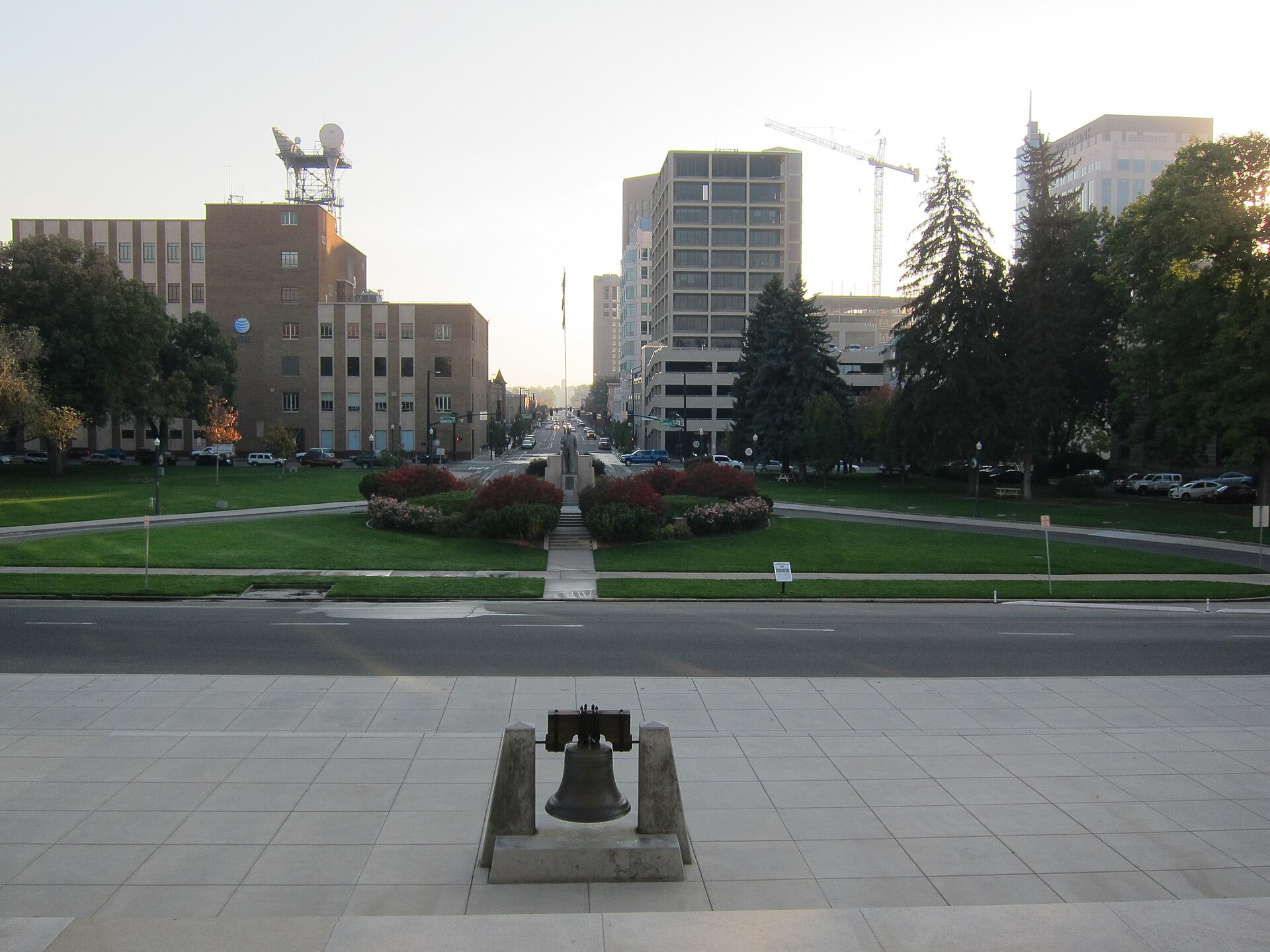
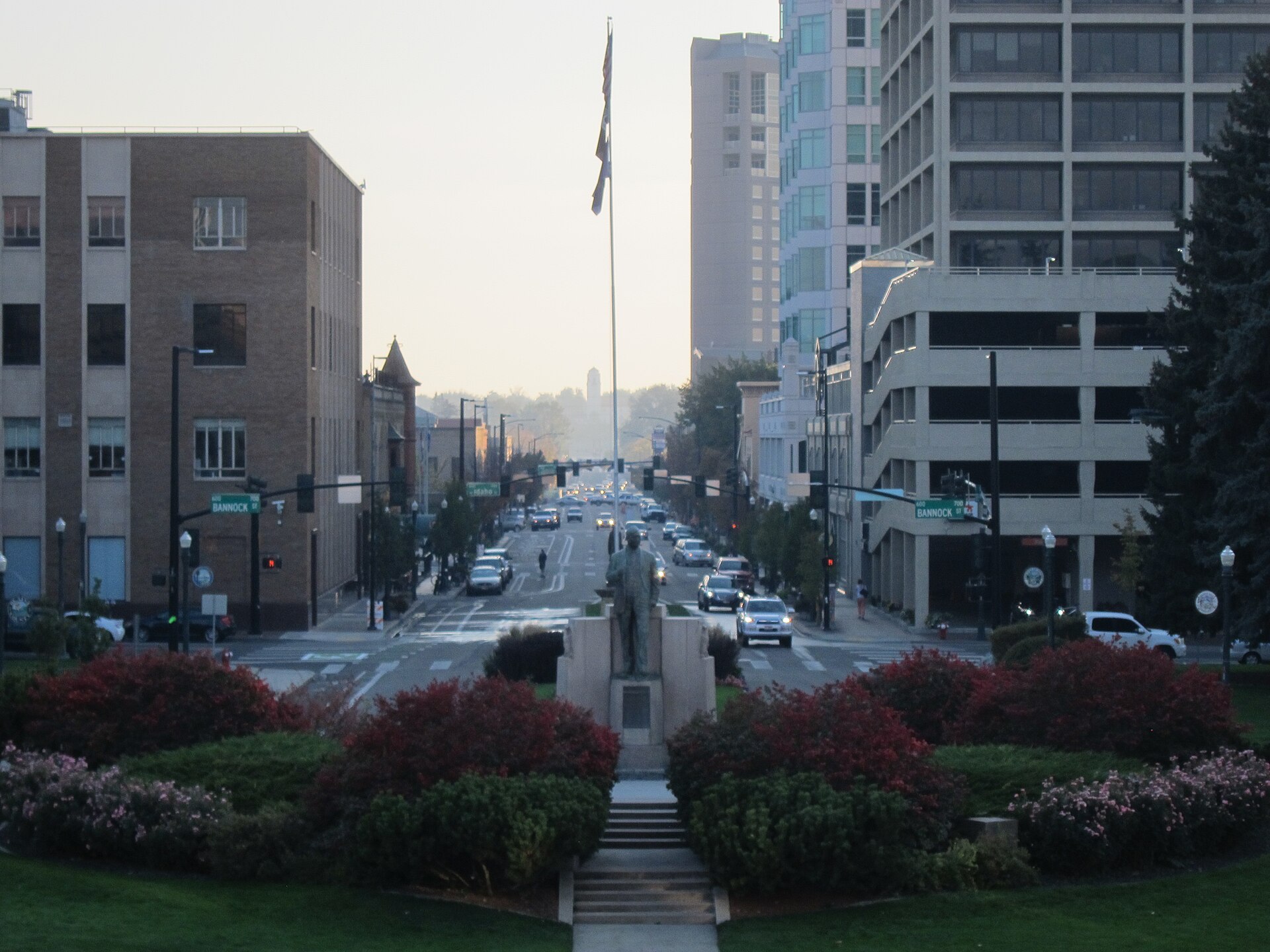
Downtown Boise has so many one-way streets because its grid was platted in the 1860s for wagons and horses, then had to absorb 20th-century car volumes without widening. Converting parallel streets into one-way pairs — one carrying traffic east, the next carrying it west — let the existing narrow blocks move more vehicles without tearing down buildings on either side.
Who actually controls the streets in Boise?
Almost none of Boise’s public streets, including downtown’s, are managed by the city itself. Ada County Highway District (ACHD) is a single countywide agency responsible for the roads, signals and signage in every city within Ada County — Boise, Meridian, Eagle, Garden City and the rest. This consolidated structure is unusual among American cities and is central to understanding why decisions about lanes and directions downtown are made at the county level, not city hall.
Where a downtown street also carries a state highway designation, the Idaho Transportation Department (ITD) has a say as well, since some of the routes threading through the core double as state or federal highway alignments. Readers wanting the current, official word on any specific street’s status can check ACHD’s own site or ITD’s site directly, since lane configurations do get revisited.
Which downtown streets actually run one-way?
Several of the core streets running through downtown are arranged as one-way pairs, meaning two parallel streets each carry traffic in a single, opposite direction rather than two-way traffic on each. Front Street and Myrtle Street are the clearest example tied to a specific piece of infrastructure: they form the surface-street pair that funnels traffic to and from the I-184 Connector at its downtown end, a relationship covered in more detail in the site’s piece on why the Connector ends where it does.
Other paired streets running through the historic grid carry the same logic on a smaller scale — one street moving traffic in one direction, its neighbor a block over moving it back. The pattern sits on top of the numbered north-south streets and named east-west streets described in the site’s broader explainer on how Boise’s grid is laid out and which way it runs, which is worth reading first if the numbering itself is unfamiliar.
Why convert streets to one-way instead of widening them?
This is a pattern repeated in dozens of American downtowns platted before the automobile and then flooded with cars after the Second World War. Widening a 19th-century block means buying and demolishing buildings on one or both sides — expensive, disruptive, and often politically impossible once a downtown has settled property lines and standing structures.
One-way conversion is the cheaper alternative. It does not add pavement. It reassigns direction across a pair of existing streets so that each one can run faster, with fewer conflicting turns and simpler signal timing, because traffic only has to be managed going one way at a time. Traffic engineers in the mid-20th century applied this same fix to grid after grid across the country, and Boise’s compact original plat — laid out for a much smaller frontier town — was a strong candidate for it once car ownership and downtown commuting both accelerated.
How does the I-184 Connector fit into this?
The Connector is the short freeway spur that brings Interstate 184 traffic into the edge of downtown before it terminates on surface streets, and its endpoint is one of the more distinctive quirks of Boise’s road network — a freeway that simply stops rather than continuing through the core.
Because that traffic has to disperse into downtown somehow, the streets it lands on — Front and Myrtle among them — were arranged as a one-way pair specifically to handle a concentrated flow entering and leaving at a single point rather than crossing traffic in both directions on the same pavement. The full story of why the freeway ends there rather than continuing is covered separately in the article on the Connector and why it ends downtown.
.jpg)
What does this mean for driving downtown today?
For a driver unfamiliar with the pattern, the practical effect is that a wrong turn onto a one-way street can mean circling several blocks to get back to where a destination actually was, since U-turns and direct backtracking are rarely straightforward on a one-way. GPS navigation generally handles this correctly, but it is worth knowing before arriving that downtown’s directional streets are not arbitrary — they follow the paired logic described above, consistently, block after block.
Parking is affected too. Because one-way streets simplify signal timing and turning movements, they also shape where on-street parking is permitted and which side of a block it sits on. The site’s guide to how parking works in downtown Boise goes into the structure of meters, garages and permit zones that sit alongside this street pattern.
Anyone deciding whether to drive downtown at all, rather than rely on walking, biking or the bus, may find it useful to read the broader assessment in whether you need a car in Boise, which weighs the one-way grid against the compact size of the downtown core it serves.
Does the one-way system affect cycling or walking?
Yes, in specific ways. One-way streets built primarily to move car traffic quickly are not automatically friendlier to people on bikes, and several of downtown’s one-way pairs carry marked bike lanes running with the flow of traffic rather than against it, which changes the route a cyclist has to plan compared with a simple two-way grid.
The site’s assessment of how good cycling actually is in Boise covers where dedicated infrastructure exists downtown and where a rider is simply sharing a one-way lane with cars. Pedestrians are less affected by directionality itself, but crossing a one-way street generally means checking a single direction of traffic rather than two, which is one of the few ways the system simplifies rather than complicates movement through downtown.
Where does downtown’s one-way network actually begin and end?
The one-way pattern is a feature of the historic core specifically, not the whole city. Once a driver moves beyond downtown’s boundaries into the surrounding neighborhoods, streets generally revert to standard two-way traffic. Readers unsure exactly where downtown itself is defined — as opposed to the North End, the Bench, or the Central Addition immediately south of it — can check the site’s explainer on what counts as downtown Boise and where its edges are.
This matters practically because a driver who assumes the one-way logic continues past the historic grid can end up making an unnecessary detour on streets that were never converted in the first place.
Is Boise likely to change any of these streets back to two-way?
Many American cities have, in recent decades, reconsidered one-way conversions made in the mid-20th century, on the argument that fast one-way traffic through a downtown core can work against pedestrian activity and ground-floor retail that the same downtown is otherwise trying to encourage. Whether Boise’s specific streets are under active review for such a change is a matter for ACHD’s own current planning documents rather than for this article to predict.
Readers with a direct interest — residents navigating downtown daily, or anyone planning a project that depends on a particular street’s configuration — should check ACHD’s published project lists and public meeting records directly, since any reconfiguration would go through that agency’s own process rather than the city’s.
Where to read next
- How Boise is laid out, and which way its streets run
- What is the Connector in Boise, and why does it end there?
- How does parking work in downtown Boise?
- More on getting around Boise
Access Boise is an independent guide written from published, checkable sources. We have not visited the places described here and we do not publish personal recommendations or invented ‘local favourites’ — where something is singled out as notable, we say who says so. Opening times, fares, closures and prices change at short notice, so treat everything here as a starting point and confirm with the museum, operator or venue directly before building a day around it. We give no advice on visas, insurance, health or safety; use your own government’s official guidance for those.
Featured image: Photo by Roman Eugeniusz, source, CC BY-SA 3.0
.jpg)