What Is Military Reserve Park?
Military Reserve Park is a city-owned park in the foothills directly east of downtown Boise, built across land that was once part of the U.S. Army’s Fort Boise military reserve. Boise Parks and Recreation manages it today as one of the busiest trailhead hubs feeding the city’s foothills trail network, along with ponds, a disc golf course, and picnic ground.
Where Is Military Reserve Park, and How Do You Reach It?
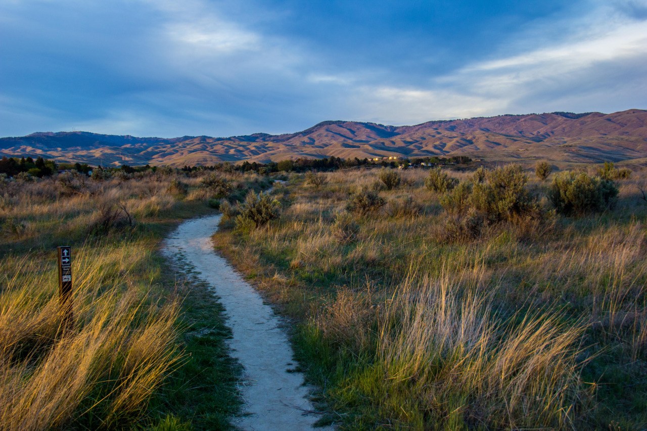
The park sits above Boise’s East End neighborhood, reached mainly from Mountain Cove Road and Sunset Peak Drive, a short drive or ride from the Old Boise High area and the Boise River. Its terrain climbs quickly from the valley floor into open sagebrush hillside, with the flat-topped landmark of Table Rock visible above much of the park.
There is no transit route running directly into the park, so the practical options are driving, cycling, or walking up from the neighborhoods below. Readers weighing whether they need a car at all in Boise can compare this park’s access against the rest of the city in Access Boise’s guide to whether you need a car in Boise, and cyclists specifically may want the broader context in the site’s look at how good cycling actually is in Boise.
How Did a City Park End Up on Army Land?
Fort Boise was established in 1863 as a U.S. Army post, set up to watch over the Oregon Trail and the mining traffic moving through the region. The Army reserved a large block of foothill and bench land around the post for training, grazing, and maneuvers, far larger than the fort’s actual built footprint.
As the post’s military role declined through the early twentieth century, portions of that reserve were released for civilian and public use. Some of the land became the Idaho Botanical Garden and the grounds around the Old Idaho Penitentiary; other portions became the VA Medical Center campus, which today holds several of the surviving Boise Barracks buildings connected to the fort’s history. Military Reserve Park is the largest remaining undeveloped piece of that original reserve, kept as open hillside rather than built over.
What Trails Start Inside the Park?
Military Reserve functions as a major junction for the Ridge to Rivers trail system, the joint program between the city, Ada County, and federal land managers that maintains the foothills trail network above Boise. Several named trails begin or pass directly through the park, connecting toward Table Rock, Camel’s Back Park, and the ridge trails further east.
Ridge to Rivers publishes its own current trail map and difficulty ratings, which is the authority to check before setting out, since trail conditions and seasonal closures change. Access Boise’s own explainer on what the Ridge to Rivers system actually is covers how the network is organized and signed, and the piece on Hulls Gulch and its reserve describes a comparable trailhead a short distance to the west, useful for understanding how these foothill entry points relate to one another.

What Else Does the Park Contain Besides Trails?
Below the steeper hillside trails, the lower part of Military Reserve is flatter and more developed. It holds a disc golf course, picnic shelters, and a small pond area that draws walkers and anglers rather than climbers and mountain bikers. This lower section is where most casual, short visits happen, distinct from the longer ridge routes above it.
- A network of hiking and mountain biking singletrack climbing into the foothills
- A disc golf course in the park’s flatter lower ground
- Pond and picnic areas near the main entrance
- Direct trail connections toward Table Rock and the wider Ridge to Rivers network
Table Rock itself, the mesa visible above much of the park, is a separate landmark with its own history and access points, covered in Access Boise’s dedicated piece on what Table Rock is and why it looks the way it does.
Is Military Reserve Park the Same as Fort Boise’s Historic Buildings?
No. The park and the fort’s surviving structures are related by land history but not by location. The historic Boise Barracks buildings sit lower, on ground now occupied by the VA Medical Center campus and the Idaho Botanical Garden, several of them noted in public historical records as connected to the original military post. Military Reserve Park is the higher, undeveloped hillside acreage from the same original Army reserve, kept as open space rather than built structures. Readers looking for the built landmarks of that era are looking at a different site than the park described here.
How Does the Season Change What the Park Offers?
Boise’s foothills trails, including those inside Military Reserve, are prone to closures after rain or snowmelt, since wet clay soil damages trails quickly under foot and tire traffic. Ridge to Rivers posts current trail status on its own site, and the sensible practice for both residents and visitors is to check that status rather than assume a trail is open.
Summer brings the opposite problem: exposed, mostly unshaded hillside that heats up fast once temperatures climb, a pattern Access Boise covers in more general terms in its guide to planning a Boise day at 100°F. Late summer and early autumn can also bring wildfire smoke into the valley, discussed in the site’s explainer on Boise’s smoke season and when it runs, which affects foothill exertion more than most flat-ground activity in the city.
What Should Visitors and Residents Know Before Going?
The park is free to enter and open to the public as city parkland, but it carries no built visitor infrastructure beyond parking, restrooms near the main entrance, and trail signage. There is little shade above the lower picnic area, and cell coverage on the ridge trails can be inconsistent, both practical points worth weighing before a longer loop.
Leash and trail-etiquette rules follow the same citywide Ridge to Rivers guidelines posted at other foothills trailheads, and the city’s own Parks and Recreation department is the source to check for current park hours and any seasonal restrictions rather than relying on secondhand listings. For a wider sense of how this kind of foothills access fits into daily life in Boise rather than a single park visit, Access Boise’s hub on what it is actually like to live in Boise and its category archive on parks and foothills both cover the surrounding pattern in more depth.
Access Boise is an independent guide written from published, checkable sources. We have not visited the places described here and we do not publish personal recommendations or invented ‘local favourites’ — where something is singled out as notable, we say who says so. Opening times, fares, closures and prices change at short notice, so treat everything here as a starting point and confirm with the museum, operator or venue directly before building a day around it. We give no advice on visas, insurance, health or safety; use your own government’s official guidance for those.
Featured image: Photo by kirk_gardner, source, BY