Hulls Gulch is a canyon that cuts into the Boise Foothills directly above the North End neighborhood, carrying a seasonal creek down toward the city. The Hulls Gulch Reserve is the protected open-space land around that drainage, owned and managed by the city of Boise, and it contains a well-known self-guided nature trail plus connections into the wider foothills trail network.
Where exactly is Hulls Gulch?
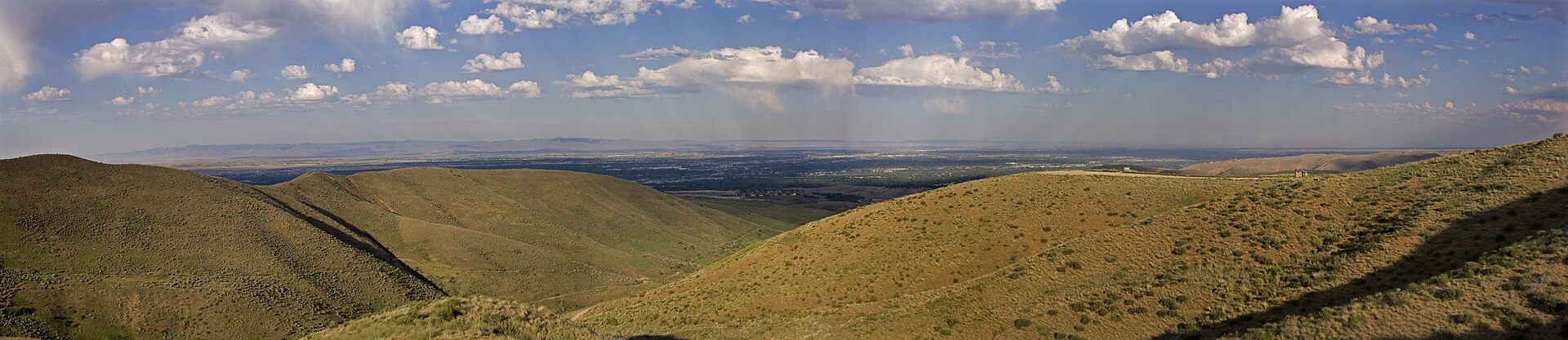
Hulls Gulch sits at the northern edge of Boise’s developed grid, where the flat streets of the North End give way abruptly to steep sagebrush slopes. The gulch runs roughly north from the top of 8th Street into the foothills, one of several similar drainages — alongside Cottonwood Creek and Crane Creek — that cut the range above the city into separate canyons and ridgelines.
Because it starts almost at the edge of the street grid, it is one of the most accessible pieces of wild foothills terrain from central Boise. There is no drive required to reach it from the North End; it is a walk or a short bike ride from streets lined with houses.
What is the Hulls Gulch Reserve, specifically?
The reserve is a parcel of open space land within the gulch that the city of Boise has set aside for habitat protection and low-impact recreation rather than development. Boise’s own account of its foothills program describes decades of land acquisition — funded in large part by a foothills open-space levy that city voters approved — aimed at keeping the slopes visible from downtown undeveloped and keeping their trails and habitat intact as the valley below has grown.
Hulls Gulch is one of the parcels that acquisition history covers. It is not a park with lawns and playgrounds; it is native foothills terrain — sagebrush steppe, bunchgrass, seasonal wildflowers, and a narrow band of streamside vegetation along the creek bottom — held and managed specifically because that habitat is limited and easily degraded by off-trail use.
What trails actually run through it?
The best-known feature inside the reserve is the Hulls Gulch Interpretive Trail, a self-guided nature trail with a series of numbered posts along its route. Each post corresponds to a description of what is growing or living at that point — sagebrush, bitterbrush, native grasses, and the birds and mammals that use them — so the trail functions as an outdoor lesson in foothills ecology as much as a hike.
Beyond the interpretive loop, Hulls Gulch connects into Ridge to Rivers, the joint trail system that the city of Boise manages together with Ada County, the Idaho Department of Lands, the Bureau of Land Management, and the U.S. Forest Service across the whole range of foothills north of the city. From Hulls Gulch, trails link toward neighboring canyons and ridgelines, so a walk that starts at a single trailhead can turn into a much longer loop for anyone who wants one.
Ridge to Rivers’ own site is the authority to check for the current map of named trails, which routes are open to hikers only versus shared with mountain bikes, and any seasonal or direction-specific rules, since the system is large and rules vary trail by trail.
How do you actually get to the trailhead?
The main access point is at the top of 8th Street, where the paved street ends and foothills trailheads begin — a point long used as one of the standard entries into this section of the range. From there, several routes head into Hulls Gulch and the surrounding drainages.
The reserve is also reachable on foot from Camel’s Back Park, the North End’s own foothills-edge park, which sits close by and is itself a starting point for several trails that eventually meet the Hulls Gulch network. For anyone without a car, this cluster of trailheads is one of the few pieces of genuine foothills hiking reachable by walking or cycling straight out of a residential neighborhood, rather than driving to a dedicated trailhead parking lot.
What wildlife and habitat does the reserve protect?
The terrain is classic Boise Foothills sagebrush steppe: dry, open slopes dominated by sagebrush and native bunchgrasses, with wildflowers concentrated in spring before the summer dry season sets in. This habitat supports mule deer, a range of raptors and songbirds, and smaller mammals typical of the sagebrush zone across the Intermountain West.
Because this habitat is slow to recover once disturbed, Ridge to Rivers and the city ask users to stay on marked trail and avoid cutting switchbacks or creating informal shortcuts — a request that matters more in a reserve like Hulls Gulch, close to the city and heavily used, than it would on more remote public land.
Why do trails here sometimes close, and when is that likely?
Ridge to Rivers closes foothills trails, including sections in and around Hulls Gulch, when they are wet enough that foot and tire traffic would cut ruts into the surface — a condition the system refers to as a wet-trail or mud closure. This tends to happen in late winter and early spring, when snowmelt and rain leave the clay-heavy foothills soil soft, and again after any heavy rain at other times of year.
The city’s own trail system posts current closures on its website and social channels rather than on a fixed calendar, because the condition depends on actual weather rather than the date. Anyone planning a specific foothills day, especially outside the dry summer months, should check the Ridge to Rivers site before heading up rather than assuming a trail is open.
How does Hulls Gulch fit into the rest of Boise’s foothills system?
Hulls Gulch is one entry point into a foothills trail network that stretches for miles north and east of the city, covering everything from short interpretive loops to long ridge routes with real elevation gain. It sits close enough to downtown and the North End that it functions as an everyday recreation resource for residents — a place for a short evening walk — as much as a destination hike.
That dual role is typical of how the foothills work for Boise as a whole. The reserve and its trails are covered in more detail, alongside the rest of the network, on the site’s own guide to the Ridge to Rivers trail system, which explains how the various agencies share management and what the trail-naming and etiquette conventions actually mean on the ground.
Is Hulls Gulch worth building a visit around?
For a short, self-contained outing, the interpretive trail is a genuine option: it is short enough to fit into part of a morning, close enough to walk to from the North End, and structured around actual information about the landscape rather than scenery alone. It works well paired with time in Camel’s Back Park, since the two sit next to each other.
For a longer foothills day, Hulls Gulch is better understood as one access point into a much larger system, and it is worth deciding on a route using Ridge to Rivers’ current map rather than assuming the interpretive loop is the only option. Either way, it is a piece of the city’s landscape that residents use routinely rather than a set-piece attraction, which is closer to how it should be approached.
Broader planning for a foothills-focused day, including how the North End and the rest of the trail network fit together, is covered in the site’s practical guide to getting around and planning in Boise and in the wider Boise guide. Related neighborhood and landmark context sits in the neighbourhoods archive and the parks and foothills archive.
Access Boise is an independent guide written from published, checkable sources. We have not visited the places described here and we do not publish personal recommendations or invented ‘local favourites’ — where something is singled out as notable, we say who says so. Opening times, fares, closures and prices change at short notice, so treat everything here as a starting point and confirm with the museum, operator or venue directly before building a day around it. We give no advice on visas, insurance, health or safety; use your own government’s official guidance for those.
Featured image: Photo by Tamanoeconomico, source, CC BY-SA 4.0
.jpg)