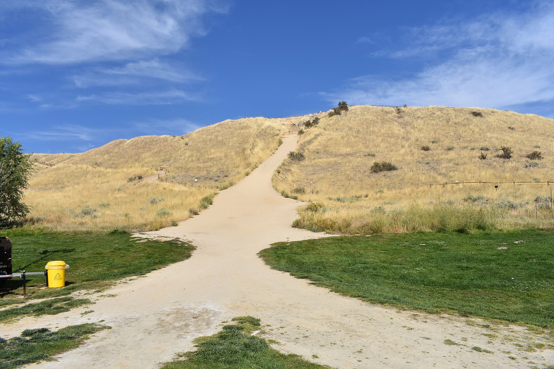
Camel’s Back Park is a city park at the edge of Boise’s North End neighborhood, named for a two-humped hill that rises immediately behind it. What starts there is the city’s foothills trail system: several marked trails, including the well-known Hulls Gulch route, begin at or near its northern boundary and climb directly into the Boise Foothills.
Where is Camel’s Back Park?
The park sits at the point where the North End’s grid of residential streets stops and the foothills begin. It is managed by Boise Parks & Recreation as one of the city’s developed neighborhood parks, distinct from the undeveloped foothills land that starts just past its edge. The North End itself is one of Boise’s oldest residential districts, and the park functions as its informal boundary with the open hillside.
Why is it called Camel’s Back?
The name comes from the shape of the hill directly north of the park’s lawns and courts: two rounded humps separated by a shallow saddle, visible from much of the North End and from downtown on a clear day. It is a landform name rather than an official geological designation, and it is the name Boise Parks & Recreation itself uses for the park.
What starts at Camel’s Back Park?
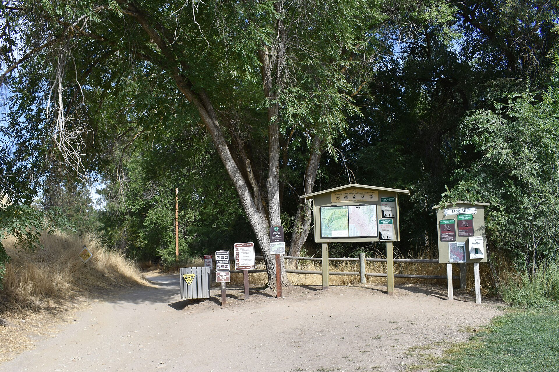
The park is the trailhead for a cluster of foothills routes. The most commonly cited is the Hulls Gulch Trail, which climbs into Hulls Gulch and connects onward into a wider network of ridge and drainage trails above the city. Other short connector trails also begin near the park, linking it to the Sunset Peak and Camelsback Reserve trail segments that make up this section of the foothills.
These trails are part of the Ridge to Rivers system — a joint program between the City of Boise, Ada County, the Idaho Department of Lands, the Bureau of Land Management, and other landholders that manages more than a hundred miles of connected foothills trail across the hillsides above the city. Ridge to Rivers publishes its own trail maps and current conditions, which is the source to check before setting out, since trail closures (especially seasonal mud closures after rain or snowmelt) are common and change without much notice.
.jpg)
What is Ridge to Rivers, exactly?
Ridge to Rivers is not a single trail or a single agency — it is the coordinating program that manages access, signage, and maintenance across foothills land owned by several different bodies. Camel’s Back Park is one of a handful of formal trailheads it recognizes on the North End side of the foothills, alongside others further along Hill Road and 8th Street. The program’s own materials describe the network as multi-use, shared by hikers, runners, and mountain bikers, with some trails restricted to specific uses or directions at different times of year.
What does the park itself contain?
Below the trailhead, Camel’s Back Park is a conventional neighborhood park. Boise Parks & Recreation lists the site as including a playground, tennis and pickleball courts, open turf, and picnic space, maintained to the same standard as the city’s other neighborhood parks rather than as a wilderness gateway. The developed park and the undeveloped hillside behind it are managed separately, even though most visitors experience them as one continuous space.
What happens there in winter?
The hill itself has a long-standing informal use as a sledding slope when snow settles on the North End, something residents have done for generations and that local news coverage returns to most winters. There is no lift, no grooming program, and no official winter infrastructure — it is simply a public hill that holds snow and sits inside city limits, which makes it accessible without a car in a way that the resort slopes above Boise are not.
How is the park used differently by residents and visitors?
For North End residents, Camel’s Back functions as a local trailhead: a short walk or bike ride from home to a hillside loop before work, or a place to take a dog on a lead into the foothills. For visitors without a car, it is one of the few foothills access points reachable on foot from downtown-adjacent neighborhoods, which is part of why it is often mentioned alongside the North End itself as a walkable pairing. Anyone planning a foothills outing from the park should treat the hillside above it as backcountry-adjacent terrain — dry, exposed, and steep in places — rather than an extension of the park’s lawns.
What is nearby?
Camel’s Back Park sits close to Hyde Park, the small commercial strip along 13th Street that anchors North End neighborhood life, and it is within the broader North End district that runs north from downtown Boise toward the foothills. Both are worth understanding on their own terms if the goal is to see how this corner of the city fits together rather than treating the park as an isolated stop.
- The park is a Ridge to Rivers-recognized trailhead into the Boise Foothills, not a foothills reserve itself.
- Trail names to expect on signage near the park include Hulls Gulch and connecting Camelsback and Sunset Peak segments.
- Current trail conditions and seasonal closures are published by Ridge to Rivers, not by the park itself.
- The developed park (courts, playground, picnic areas) is a standard Boise Parks & Recreation facility, run separately from the trail network above it.
What should someone check before going?
Because trail access, mud closures, and any seasonal restrictions are set by the Ridge to Rivers program rather than fixed permanently, anyone planning a hike or ride from Camel’s Back Park should confirm current status on Ridge to Rivers’ own site before arriving, particularly in late winter and early spring when foothills trails close to protect wet ground. The same caution applies to opening hours or facility changes at the park itself, which are set by Boise Parks & Recreation.
For a wider sense of how this kind of foothills access fits into the rest of the city, the Parks & Foothills archive and the Boise Practical hub cover related terrain, while the North End neighborhood history and Hyde Park pages cover the district the park sits inside. Readers comparing this trailhead to other foothills landmarks may also want Table Rock, and those weighing whether a car is needed at all can check how cycling works in Boise or a Boise day that is entirely outdoors for how a foothills stop fits into a longer plan.
Related reading
what the city is like to actually live in, museums, landmarks, neighbourhoods and day trips, What Is It Like to Be Outdoors in Boise Year Round?
Access Boise is an independent guide written from published, checkable sources. We have not visited the places described here and we do not publish personal recommendations or invented ‘local favourites’ — where something is singled out as notable, we say who says so. Opening times, fares, closures and prices change at short notice, so treat everything here as a starting point and confirm with the museum, operator or venue directly before building a day around it. We give no advice on visas, insurance, health or safety; use your own government’s official guidance for those.
Featured image: Photo by Tamanoeconomico, source, CC BY-SA 4.0
.jpg)