A day entirely outdoors in Boise works because three systems sit next to each other and connect directly: the Boise River and its paved Greenbelt path, the city’s own foothills trail network, and a set of open-air institutions — a bird conservation campus, a former penitentiary’s grounds, a botanical garden — that don’t require stepping indoors to make sense of. The day is built by choosing a slice of each, not by rushing all three.
What’s the spine that holds the day together?
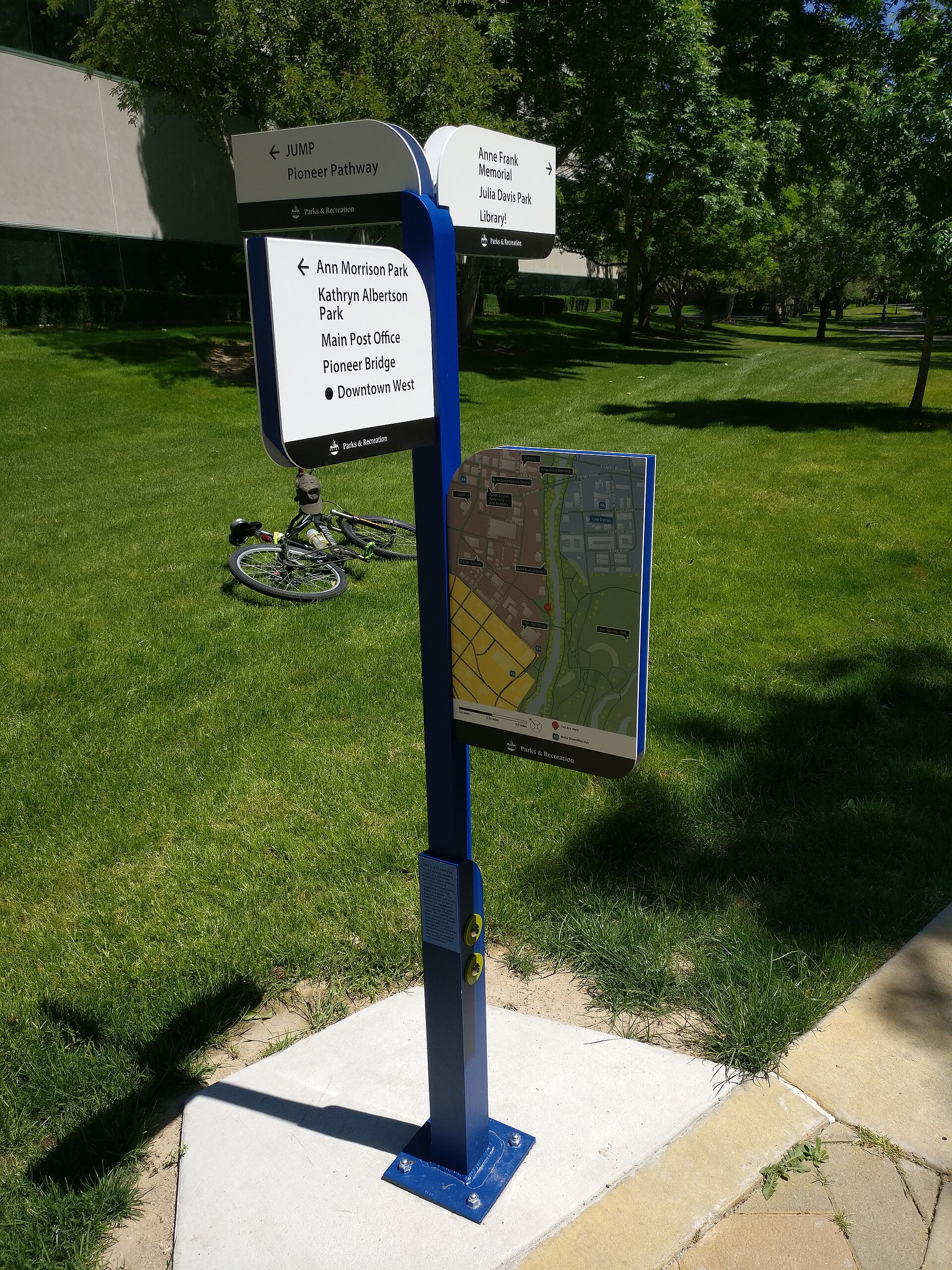
The Boise River is the spine. It runs east to west through the city, and the Boise Greenbelt — a paved, mostly flat multi-use path — follows it for roughly 25 miles, linking parks, a whitewater park, and several neighborhoods without a single traffic light. It is the one piece of the day that requires no trailhead, no car, and no elevation gain.
The Greenbelt is maintained by the city’s parks and recreation department, and it functions differently depending on the stretch: near Ann Morrison Park and Julia Davis Park it’s dense with foot traffic and river access points; farther east or west it thins out and becomes closer to a commuter corridor. The city’s own Greenbelt commuting guide covers how residents actually use it as infrastructure rather than scenery, which matters if the plan includes covering real distance on foot or by bike.
How do the foothills fit into one day?
The foothills sit directly north of downtown and are reachable by trail within a few miles of the city center, which is unusual for a state capital of Boise’s size. The system is called Ridge to Rivers — a joint city, county, and Bureau of Land Management program — and its own materials describe several hundred miles of interconnected trail across the hillside above the North End and East End.
A single day doesn’t need the whole system. It needs one loop. Table Rock, the flat-topped sandstone formation visible from much of downtown, is one of the more commonly cited destinations because it can be reached on foot from lower trailheads or by a short drive, and it looks down over the Old Idaho Penitentiary grounds and the Idaho Botanical Garden below. What Table Rock actually is, geologically and historically, is covered separately in this guide’s piece on Table Rock.
Above Table Rock, the hillside carries the Boise hillside letters — large concrete letters set into the slope, maintained informally over decades — which this site’s article on the hillside letters covers as a piece of local visual history rather than a hiking destination in its own right.
What about the river itself, not just the path beside it?
In summer, the Boise River is used for floating — an inflatable-tube trip that typically runs from Barber Park downstream toward Ann Morrison Park, a stretch of a few miles that takes an hour or two depending on flow. This is a seasonal, weather- and water-level-dependent activity rather than a year-round one, and flow rates are managed upstream, so conditions vary year to year. Idaho Fish and Game publishes fishing regulations for the river’s sections, since much of it also supports a trout fishery inside city limits — a detail that surprises people who assume urban rivers don’t carry fish.
The whitewater park near downtown, built into the river channel itself, is a separate piece of infrastructure aimed at kayakers and surfers using standing waves rather than tubers, and it operates on its own schedule tied to water releases.

Where does Bogus Basin fit if the day allows more elevation?
Bogus Basin is a ski area roughly 16 miles north of downtown, up a mountain road that climbs several thousand feet out of the valley. In winter it’s a downhill and Nordic ski operation; outside snow season, it operates on a reduced summer schedule with some lift-served or trail access, which this guide’s piece on what the Bogus Basin road is actually like lays out in more detail, including what the drive itself involves. For a day without a car, getting to Bogus Basin without a car explains the seasonal shuttle option, which is the only public transit link and does not run year-round — confirm current service on the operator’s own site before planning around it.
Bogus Basin is a bigger commitment than the foothills trails closer to downtown — the drive alone takes the better part of an hour round trip — so it tends to replace the rest of the day rather than fit alongside it.
Does the World Center for Birds of Prey belong in an “outdoors” day?
Partly. The World Center for Birds of Prey, run by the Peregrine Fund south of the city, combines an indoor interpretive center with outdoor flight demonstrations and raptor enclosures, and its focus is conservation breeding of species including the California condor and peregrine falcon. It isn’t a hike or a trail, but it is a working outdoor facility rather than a museum in the conventional sense, and this guide’s article on the center covers what it holds and how a visit is structured.
Does the season change what this day actually looks like?
Yes, more than almost anything else about the plan. Boise sits at moderate elevation with low humidity, and the practical effect is a wide temperature swing across the year that this site’s piece on Boise’s elevation and dry air explains in plain terms.
- Summer afternoons regularly reach the high 90s or low 100s Fahrenheit, which changes the sensible order of an outdoor day — river and shade before midday, foothills trails at dawn or dusk. The site’s straight answer on planning a Boise day at 100°F covers how that reordering actually works.
- Winter brings a temperature inversion in the valley on some days, trapping cold, stagnant air below the foothills while the hillside above sits in sun — a genuinely different outdoor experience a few hundred feet apart, covered in how to plan a Boise day during the inversion.
- Late summer and early fall can bring wildfire smoke drifting into the valley from regional fires, which affects air quality on the Greenbelt and in the foothills alike. The pattern of Boise’s smoke season is worth checking before committing a full day to being outside.
Do you need a car to make this day work?
Not for the river and Greenbelt portion, which is walkable or cyclable from most central neighborhoods. The foothills trailheads nearest downtown are also reachable on foot or by bike from the North End and East End. Bogus Basin, by contrast, is difficult without a vehicle outside of the limited seasonal shuttle already mentioned. The broader question of whether Boise requires a car at all covers how this splits across the rest of the city, and how good cycling in Boise actually is is relevant if the day is built around a bike rather than on foot.
What should a visitor versus a resident actually do with this?
A visitor with one day to spend outdoors is generally better served by staying close: the Greenbelt between Ann Morrison Park and the river’s whitewater park, plus one lower foothills trail, covers the range of terrain in a few hours without a car and without a long drive eating into the day.
A resident planning a genuinely full outdoor day — one that uses the foothills seriously, not as an afterthought — is better served by treating the Ridge to Rivers network as a system to learn over a season rather than a single trailhead to visit once, since different trailheads suit different times of year and different crowd levels depending on aspect and shade.
Either way, dressing for the day matters more in Boise than in a lot of cities, given how far temperatures swing within a single 24-hour period; this site’s guide to how to dress for a Boise day in any season is a reasonable starting point before committing to a full day outside.
Access Boise is an independent guide written from published, checkable sources. We have not visited the places described here and we do not publish personal recommendations or invented ‘local favourites’ — where something is singled out as notable, we say who says so. Opening times, fares, closures and prices change at short notice, so treat everything here as a starting point and confirm with the museum, operator or venue directly before building a day around it. We give no advice on visas, insurance, health or safety; use your own government’s official guidance for those.
Featured image: Photo by Kencf0618, source, CC BY-SA 4.0
