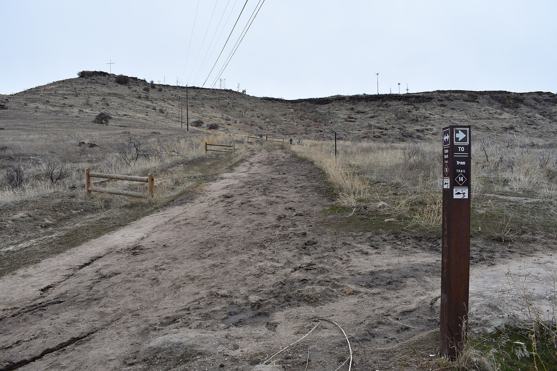
The Table Rock trail is a foothills route that climbs roughly 700 to 800 feet from Boise’s East End up onto the flat sandstone mesa known as Table Rock. It is short but steep, almost entirely exposed to sun, and rated moderate to strenuous by the city’s own Ridge to Rivers trail programme because of the grade rather than the distance.
What is Table Rock, exactly?
Table Rock is a broad, flat-topped sandstone butte on the eastern edge of Boise, rising above the Old Idaho Penitentiary State Historic Site and the East End neighborhood. It is one of the most visible landforms in the city, identifiable from downtown by the lighted cross and the radio and television transmission towers on its summit. A separate Access Boise article covers what Table Rock is as a landmark, including its quarry history and the structures on top of it. This article deals specifically with the trail: where it runs and what it demands of a hiker.
Where does the trail start?
The most commonly used trailhead sits near the Old Idaho Penitentiary complex, on the eastern flank of Boise’s East End neighborhood, an area covered in more depth in the Access Boise piece on the East End neighborhood. From there the trail climbs directly up the face of the butte through a series of switchbacks. The route is part of the city’s Ridge to Rivers network, a shared system of foothills trails maintained through a joint effort of Boise, Ada County and the U.S. Bureau of Land Management; the mechanics of that system are explained in the Access Boise guide to the Ridge to Rivers trail system. Because Table Rock also has a paved and gravel road to its summit, some visitors drive up rather than walk, which changes the experience but not the trail itself.
How hard is the hike, in practice?
The difficulty comes from grade and exposure rather than length. Ridge to Rivers describes its foothills trails using a difficulty scale posted on trailhead signs and its own maps, and the routes up Table Rock fall into the moderate-to-strenuous range on that scale. A hiker should expect:
- A sustained, unshaded climb with little flat ground until the top of the mesa
- Loose sandstone gravel underfoot on parts of the trail, which affects footing more than the elevation gain does
- Full sun exposure for nearly the entire route, with no tree cover to speak of
- A summit that is broad and largely flat, used by some for running or walking loops once the climb is finished
None of this makes the trail technical. It requires no equipment beyond what any foothills hike in Boise calls for. But the combination of steep grade and full sun is exactly what makes it feel harder than its short distance suggests, particularly in the warmer months.
.jpg)
Why does the sun and heat matter so much here?
Boise’s foothills, including Table Rock, sit at a lower, drier elevation than the surrounding mountains, and summer afternoons regularly push into the upper 90s and above. The Access Boise guide on planning a Boise day at 100°F covers how that heat reshapes a day’s schedule, and the same logic applies directly to Table Rock: there is no shade canopy on the climb, and the sandstone surface radiates heat back once the sun is on it. A hike that would be routine in spring becomes a different proposition in July or August, and locals generally shift the climb to early morning or evening in summer for that reason.
Does wildfire season change anything?
Smoke from regional wildfires can settle into the Treasure Valley in late summer, reducing visibility and air quality across the foothills, Table Rock included. The Access Boise article on Boise’s wildfire season explains how that pattern recurs most years and what it does to outdoor plans generally. Anyone checking conditions before a Table Rock hike should look at current air quality reporting rather than assume a clear day from a photo taken weeks earlier.
What is the sandstone, and why does it matter to the city?
The rock that gives Table Rock its name and its flat top is sandstone quarried directly from the site for well over a century. Stone taken from Table Rock was used in the construction of the Idaho State Capitol and the Old Idaho Penitentiary, both documented by the Idaho State Historical Society. The Access Boise guide to visiting the Idaho State Capitol covers the building the quarry helped supply. Quarrying activity on Table Rock is part of why the summit is a working, altered landscape rather than an untouched one — the towers, cross, and access road sit alongside old quarry cuts still visible in the rock face.
What is at the top?
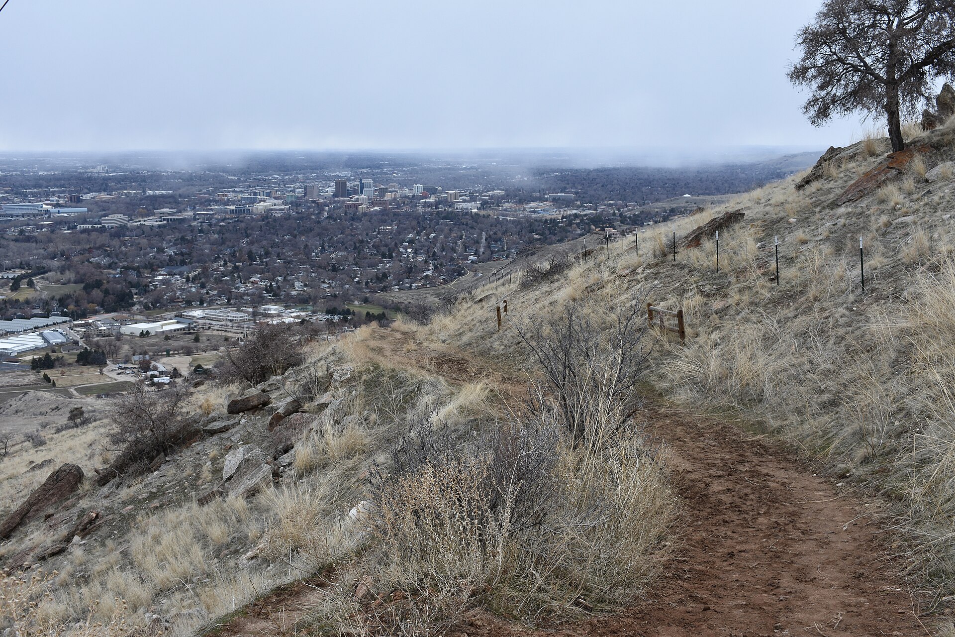
The mesa top is flat, open, and largely without vegetation cover, dominated by the transmission towers that serve Boise-area broadcasters and the lit cross visible from much of the city at night. The views from the edge take in the Boise River valley, the downtown skyline, and, on clear days, the Owyhee Mountains to the southwest. There are no visitor facilities on the summit — no restrooms, water, or shade structures — which is consistent with its status as working land rather than a developed park.
Do you need a car to reach it?
A car makes the approach easier, since the main trailhead near the Old Penitentiary sits east of downtown and is not directly on the Greenbelt or a major bus corridor. The Access Boise guide to spending a day in Boise without a car covers how walkable and transit-dependent routes work elsewhere in the city, and Table Rock is one of the destinations where a car, rideshare, or a longer walk from the East End is the more realistic option compared with downtown landmarks.
What should someone check before going?
Trail conditions, seasonal closures, and current difficulty ratings are maintained directly by the city’s Ridge to Rivers programme, and hikers should confirm current status on that programme’s own site rather than rely on a fixed description here, since foothills trails are periodically rerouted or closed for erosion control. Wildlife guidance for the foothills, including rattlesnake activity in warmer months, is published by Idaho Fish and Game and is worth reviewing before a summer hike specifically.
For context on how Table Rock fits into Boise’s wider network of foothills trails and parks, the Access Boise category on parks and foothills collects related guides, and the hub page on living in Boise covers how residents use the foothills trail system as a year-round part of daily life rather than an occasional outing.
Access Boise is an independent guide written from published, checkable sources. We have not visited the places described here and we do not publish personal recommendations or invented ‘local favourites’ — where something is singled out as notable, we say who says so. Opening times, fares, closures and prices change at short notice, so treat everything here as a starting point and confirm with the museum, operator or venue directly before building a day around it. We give no advice on visas, insurance, health or safety; use your own government’s official guidance for those.
Featured image: Photo by Tamanoeconomico, source, CC BY-SA 4.0
.jpg)