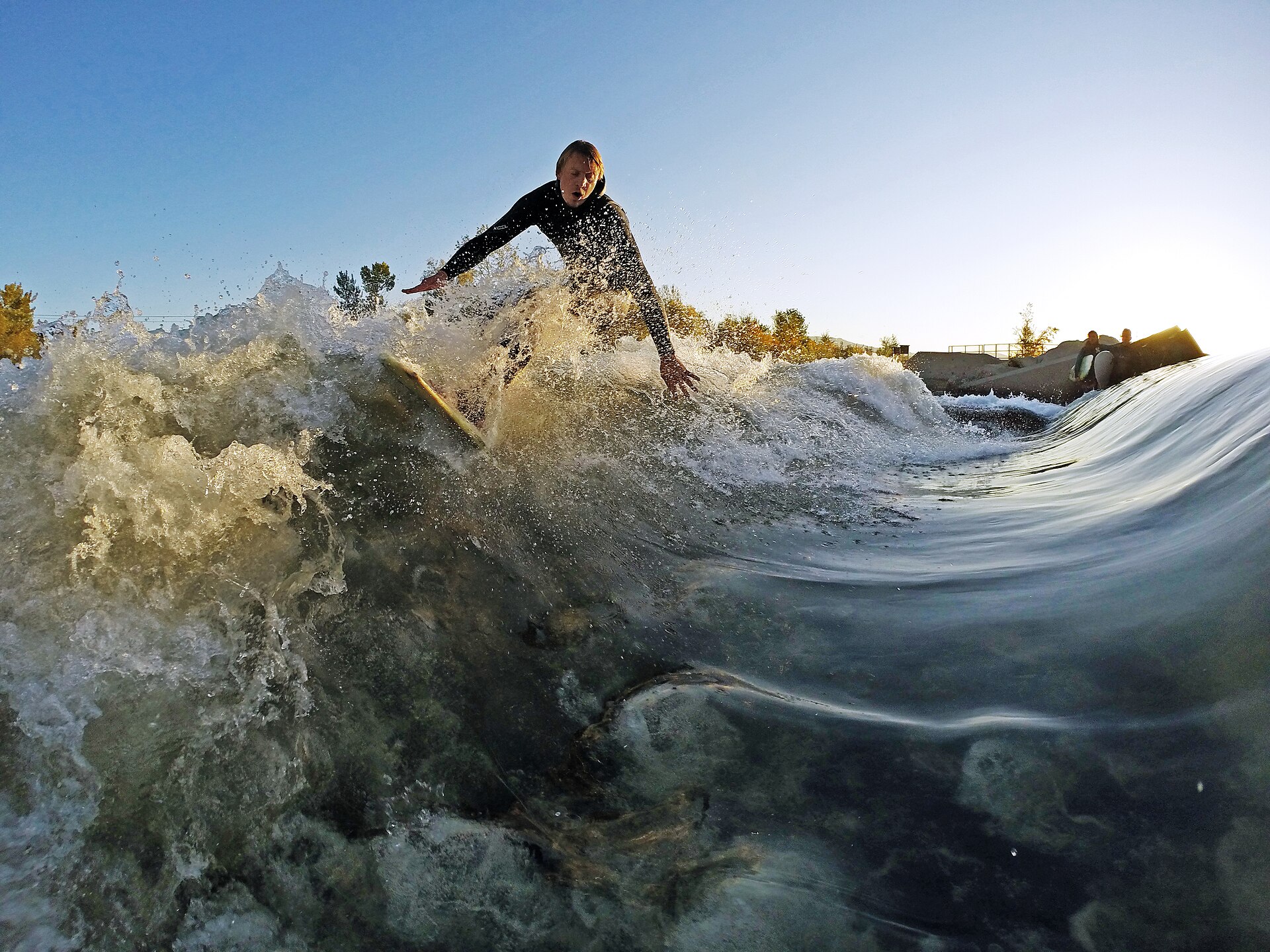
The Boise Whitewater Park is an engineered stretch of the Boise River, west of downtown, where the city has installed adjustable underwater features that create standing waves and surf holes. It is built and owned by the city of Boise, it is free to use, and it functions less like a facility with a gate than a section of open river shaped for kayaking, river surfing, tubing and paddleboarding.
What is the Boise Whitewater Park, exactly?
It is a public river feature, not a building or an enclosed venue. The city of Boise’s parks and recreation department describes it as a whitewater park built into the natural channel of the Boise River, using submerged, adjustable gates rather than a constructed concrete flume. The idea is to take an ordinary reach of river and give it the capacity to produce a surfable wave or a runnable rapid on demand, at different river flows and for different skill levels.
This distinguishes it from artificial whitewater courses that divert water into a separate channel. The Boise version sits inside the river itself, which means its behavior changes with the river’s own seasonal flow, not just with how the gates are set.
Where is it located?
The park sits on the Boise River near Whitewater Park Boulevard, in the cluster of river-facing parkland west of the Boise State University campus and downtown. It is part of the same river corridor as Kathryn Albertson Park and the pond and paddling areas informally grouped under Quinn’s Pond and Esther Simplot Park. The exact footprint and access points are described on the city’s parks and recreation site, which is the authority to check before visiting for current conditions.
The Boise River Greenbelt runs directly past the site, so it is reachable on foot or by bike from much of the river corridor without needing to drive to a dedicated entrance.
How do the waves actually work?
The park uses movable gates or bladders installed on the riverbed that can be raised or lowered to change how water piles up and breaks as it moves downstream. Raising a gate concentrates the flow and steepens the wave; lowering it flattens the feature into a simple riffle or channel.
Because the underlying river flow is not constant, park operators adjust these features through the season rather than setting them once. The city’s own materials on the park explain that features are tuned to match irrigation-season releases, winter base flows, and the different skill levels of the people using the river on a given day. This is standard practice for river-based whitewater parks generally, and it is why the same stretch can feel like a gentle current in one season and a genuine surf wave in another.

Who actually uses it?
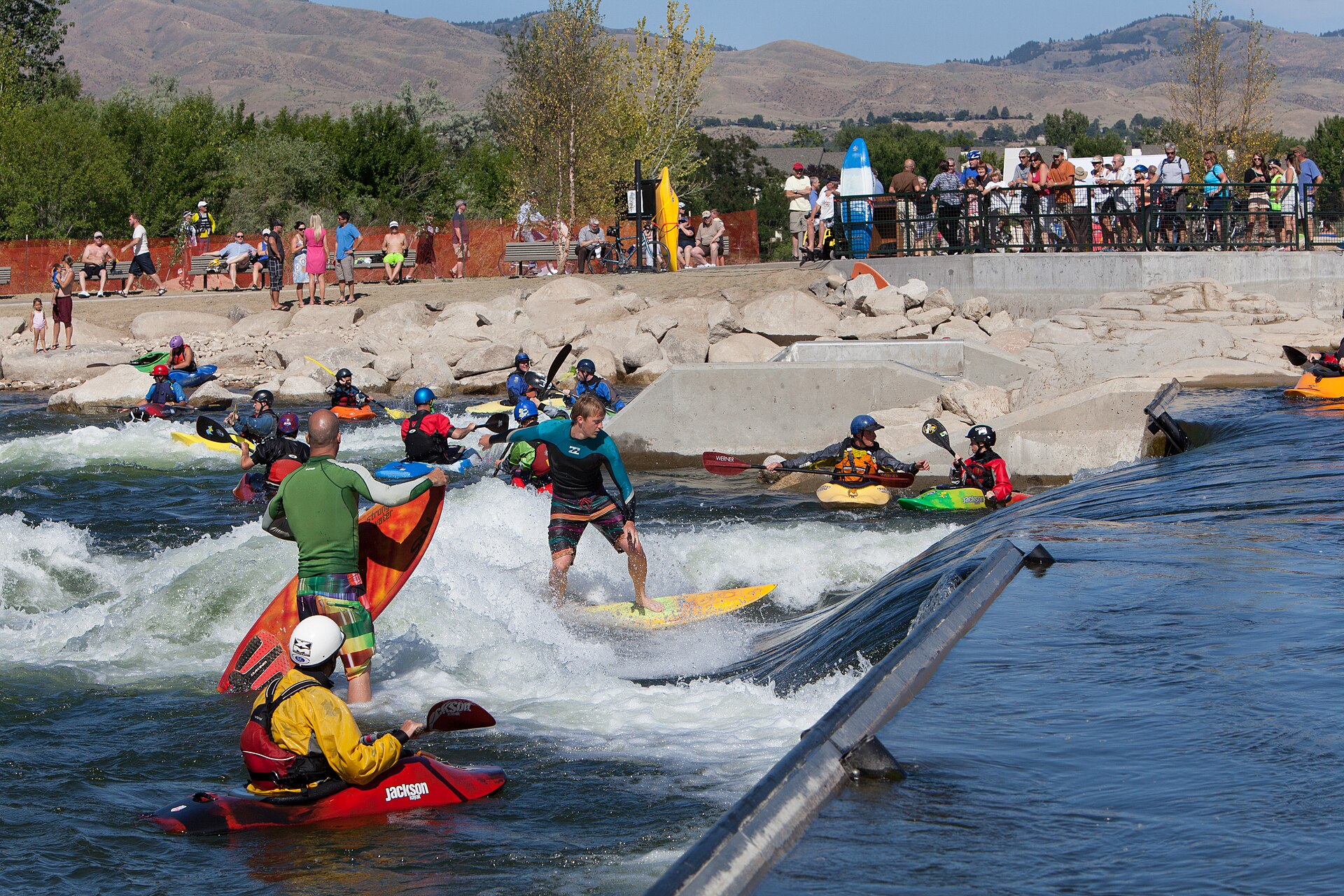
The park was built for river paddlers, and that remains its core audience: kayakers running or surfing the wave feature, and river surfers riding it standing up on a board, sometimes tethered to a rope anchored at the bank. Stand-up paddleboarders and tubers also use the calmer sections nearby.
Spectators are part of the pattern too. Because the wave sits right along the Greenbelt path, it is a stretch where people walking or cycling the river commonly stop to watch paddlers work the feature, without needing any ticket or entry point to do so.
Is it free, and who manages it?
The park is a public amenity of the city of Boise, managed through its parks and recreation department, and there is no admission fee to use the river or watch from the bank. As with any river feature, conditions, gate settings and any temporary closures for maintenance or flow changes are the city’s own operational decisions, and its parks and recreation site is the correct place to confirm current status before visiting, since river conditions are not fixed year-round.
Anyone bringing a kayak, board or tube is subject to the same river conditions as any other user of the Boise River — this site does not offer safety guidance on currents, flows or personal equipment, and readers should treat the river with the seriousness any moving water requires and consult official river-flow and safety information before entering the water.
How does the river’s flow change through the year?
The Boise River is a managed river, with releases tied to irrigation demand upstream at Lucky Peak, Arrowrock and Anderson Ranch reservoirs. Flow is typically higher through the irrigation season in warmer months and lower in winter, and this directly affects how the whitewater park’s features perform, since the gates are working with whatever volume of water is coming through on a given day.
This also means the park is at its most active, in terms of both water volume and paddler traffic, during the same stretch of the calendar when the rest of the river corridor is busiest — a pattern worth understanding alongside general guidance on what Boise summer heat is actually like and how it shapes river use across the city.
What else sits nearby?
The whitewater park is one piece of a larger river-park cluster on Boise’s west side. Quinn’s Pond, a spring-fed pond used for swimming and casual floating, sits close by, as does Kathryn Albertson Park, a quieter wildlife-focused park with ponds and walking trails rather than paddling features. Further along the Greenbelt toward downtown are Ann Morrison Park and Julia Davis Park, both larger, older riverside parks with their own distinct roles in the city’s park system.
Together these form a continuous stretch of river-facing public land that functions differently at each point — passive and reflective at Kathryn Albertson, active and athletic at the whitewater park, broad and event-oriented at Ann Morrison and Julia Davis.
How do you get there without a car?
The Greenbelt path connects the whitewater park directly to downtown Boise and to Boise State University on foot or by bike, and the corridor is one of the more consistently used cycling routes in the city. Readers relying on walking, cycling or transit rather than a car can find general guidance in the city’s coverage of cycling in Boise and whether a car is necessary in Boise at all.
Because there is no single formal entrance or car park attached to the park in the way a museum or landmark has one, most visitors approach it as a stop along the Greenbelt rather than a discrete destination reached directly by road.
How does it fit into the rest of the river system?
The whitewater park is best understood as one functional zone within Boise’s broader relationship to its river — a working waterway that is simultaneously an irrigation resource, a wildlife corridor and a recreational spine running through the middle of the city. That relationship, including the Greenbelt path that ties all of it together, is covered in more general terms in the site’s guide to the Boise River Greenbelt end to end, and in the broader Parks & Foothills archive.
Readers building a wider picture of how the city organizes its outdoor space, and how a single river can carry a wildlife park, a swimming pond and an engineered surf wave within a few hundred meters of each other, can start from the Access Boise guide to the city’s museums, landmarks and neighbourhoods or the practical planning hub at Boise Practical, which covers getting around, day plans and how the city’s outdoor spaces are actually used through the year. Those living in the city rather than visiting it will find more on how neighborhoods and river access fit daily life in the Living in Boise hub.
Access Boise is an independent guide written from published, checkable sources. We have not visited the places described here and we do not publish personal recommendations or invented ‘local favourites’ — where something is singled out as notable, we say who says so. Opening times, fares, closures and prices change at short notice, so treat everything here as a starting point and confirm with the museum, operator or venue directly before building a day around it. We give no advice on visas, insurance, health or safety; use your own government’s official guidance for those.
Featured image: Photo by HannahBananaMae, source, CC BY-SA 4.0
