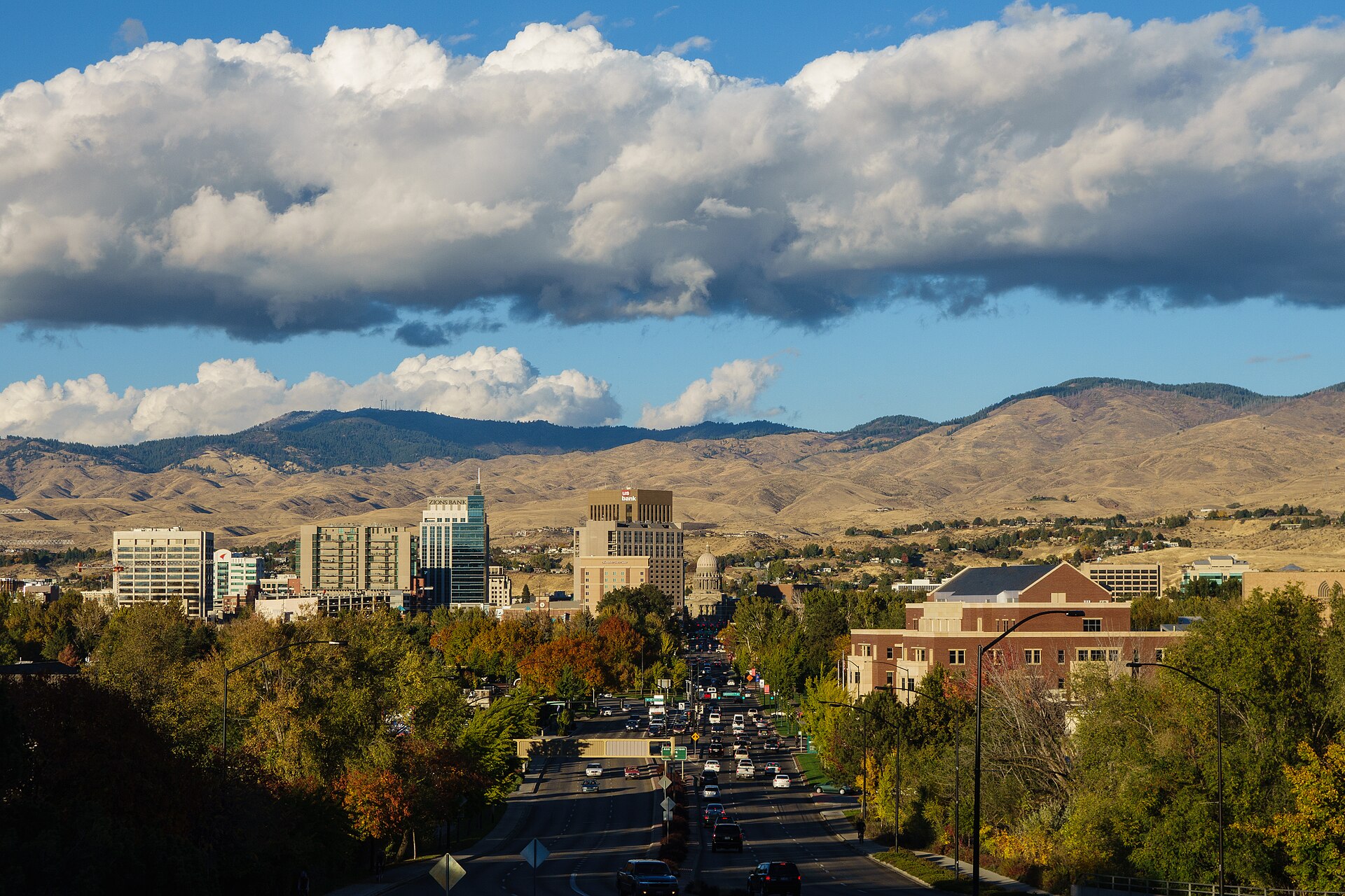
Boise sits at roughly 2,700 feet (about 830 meters) above sea level, in a high desert basin between the Boise Front foothills and the Snake River Plain. The elevation itself is moderate — not mountain-town high — but combined with low humidity and intense sun, it changes how heat, cold and altitude feel day to day. Most of the effect comes from dryness, not height.
How high up is Boise, exactly?
The National Weather Service lists Boise Air Terminal’s elevation at approximately 2,730 feet. Downtown, closer to the Boise River, sits a little lower; the benches and foothills neighborhoods above the river rise higher still. None of this qualifies as high-altitude in the way Denver or mountain towns in central Idaho do — Boise is a valley city, not a mountain one.
The relevant comparison point is nearby: Bogus Basin, the ski area above the city, sits at a base elevation over 5,800 feet and climbs from there. The drive up gains more than 3,000 feet in under 20 miles, which is why conditions at the top can differ sharply from downtown even on the same afternoon. Details on that climb are covered in the guide to Bogus Basin’s access road.
Why is the air in Boise so dry?
Boise’s climate is classified as semi-arid, sitting in the rain shadow of the Cascade and Sierra Nevada ranges to the west and the Rockies to the northeast. Pacific storm systems lose most of their moisture before reaching the Snake River Plain. The National Weather Service records average relative humidity in Boise as low across most of the year, particularly in summer afternoons, when it can drop into the teens or single digits by percentage.
This is a defining fact about the city’s climate, more consequential day-to-day than the elevation number itself. Dry air changes how heat, cold, sun and wind are all experienced, and it shapes practical decisions from what to pack to how the body reacts to a day outdoors.
Does dry air make summer heat feel different?
Yes. Boise summers regularly reach the mid-90s to low 100s Fahrenheit, and the dry air means heat is felt as intense direct sun and rapid evaporation rather than the oppressive stickiness of humid climates. Bodies lose moisture faster than they register it, which raises the risk of dehydration even when the heat feels tolerable.
The city’s summer pattern — including how the heat builds through the day and what shade and water access actually look like — is covered in more detail in the guide to what a Boise summer is actually like. That article addresses the practical side of heat management; this one focuses on the underlying climate mechanics.
Dry heat also means temperature swings between day and night are larger than in humid regions. A 95°F afternoon can drop to the 60s after dark, because there’s little moisture in the air to hold heat overnight. That swing is a genuine planning factor for anyone spending an evening outdoors downtown or in the foothills.
What does dry air mean for winter and the inversion?
Winter in Boise is generally milder and drier than in humid-climate cities at similar latitude, but the valley is prone to temperature inversions — periods when cold, stagnant air pools near the valley floor beneath a layer of warmer air, trapping haze, fog and pollutants close to the ground. Idaho’s Department of Environmental Quality and local news coverage both document this as a recurring winter feature of the Treasure Valley, not an occasional anomaly.
The inversion is a separate phenomenon from the elevation and dryness discussed here, but the two interact: the same bowl-shaped basin that produces dry summers can trap stagnant air in winter. A full explanation of how the inversion forms and what it changes about daily life is available in the piece on Boise’s winter inversion, and the broader seasonal picture is covered in what a Boise winter is actually like.
Does the elevation cause altitude sickness?
At roughly 2,700 feet, Boise itself is well below the elevation range where altitude sickness typically becomes a concern for most travelers — medical guidance generally associates altitude illness with elevations above 8,000 feet, reached quickly. Boise doesn’t meet that threshold.
The consideration changes once a visit extends up toward Bogus Basin or into the higher terrain of the Boise Front, where elevations climb several thousand feet above the valley floor. This site does not offer medical guidance; anyone with health concerns about elevation, exertion or existing conditions should consult a physician or their government’s official travel health guidance before planning strenuous activity at altitude.
What does the dry air actually do to skin, breathing and hydration?
Low relative humidity draws moisture out of skin, lips and nasal passages faster than in humid climates, which is why dry skin, chapped lips and nosebleeds are commonly reported complaints among both residents and visitors, particularly in winter when heated indoor air compounds the effect. None of this is unique to Boise — it’s typical of semi-arid interior West climates generally — but it catches visitors from humid regions off guard.
Sun exposure is a related factor. At Boise’s latitude and elevation, UV exposure during summer can be more intense than the temperature alone suggests, because dry, clear air offers less atmospheric filtering than hazier, more humid conditions. This is standard advice repeated across public health guidance for high-desert climates rather than a Boise-specific finding, but it applies directly here.
Practically, the dry air argues for:
- Drinking water more deliberately than thirst alone would prompt, especially during summer outdoor activity
- Sun protection even on days that don’t feel especially hot
- Basic skin and lip care, particularly for visitors arriving from humid climates
How does elevation and dryness shape the landscape itself?
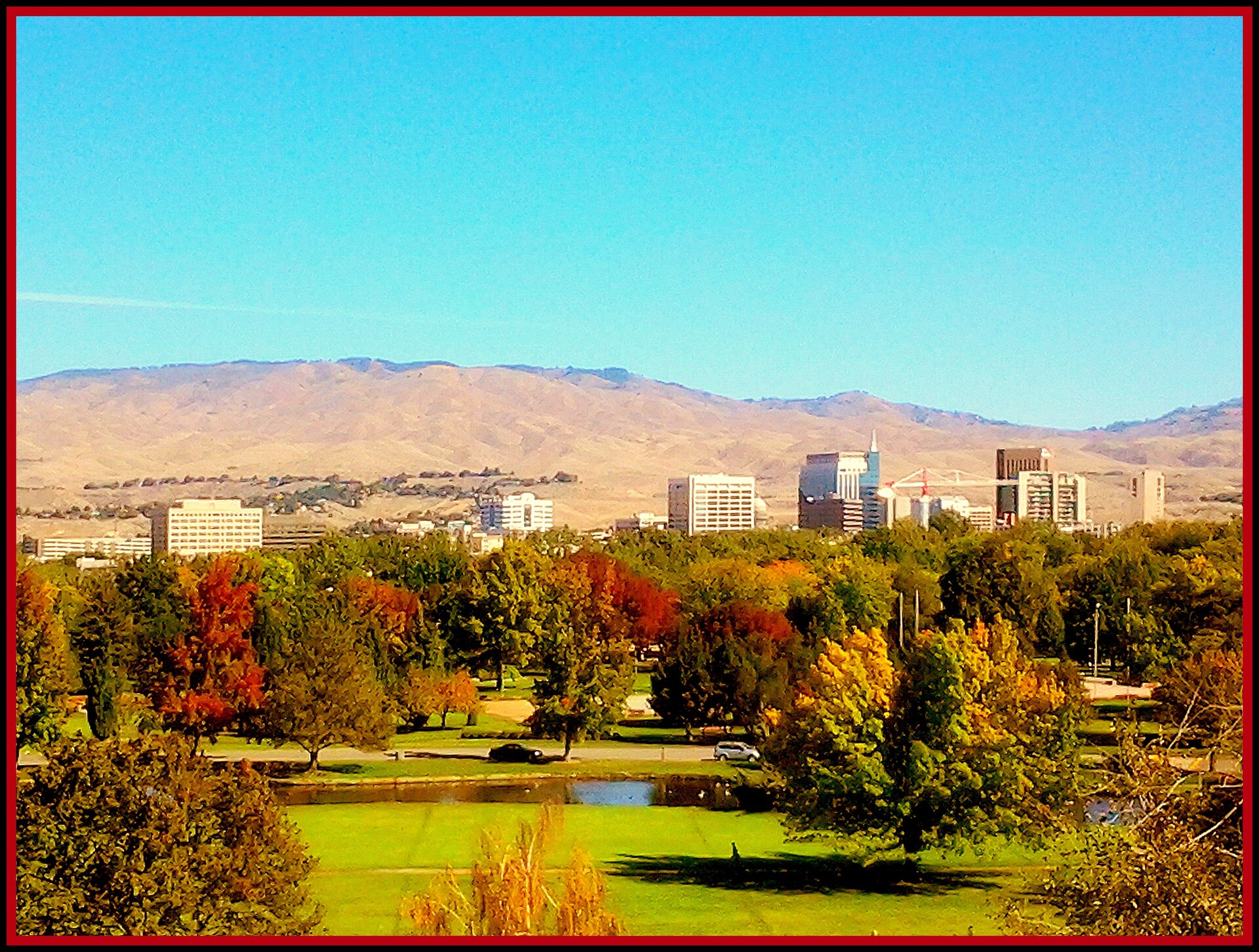
The semi-arid climate is why the terrain immediately around Boise looks the way it does: sagebrush and dry grassland on the foothills rather than dense forest, with irrigation doing the work of turning the valley floor into farmland, parks and tree-lined streets. The contrast between the green, irrigated city grid and the dry hills rising directly behind it is one of the more visually distinctive things about Boise’s setting, and it’s a direct consequence of the climate rather than a design choice.
That dry foothill terrain is also what makes features like Table Rock and the network described in the city’s own Ridge to Rivers trail program viable close to downtown — exposed rock, sparse vegetation and minimal tree cover mean trails dry out quickly after rain or snow and stay accessible much of the year, though summer heat and winter ice both affect conditions. The Idaho Botanical Garden, by contrast, is a cultivated counterpoint — a deliberately irrigated landscape set against the dry grounds of the former penitentiary site it occupies.
Does the elevation affect flights or driving into Boise?
Boise Airport’s elevation is unremarkable for commercial aviation and doesn’t meaningfully affect flight operations the way high-altitude airports elsewhere can. Where elevation becomes more relevant to travel is on routes climbing out of the valley — into the mountains toward Sun Valley, or up the Bogus Basin road — where grade, not base elevation, is the main driving consideration. Details on arriving in the city itself are covered in the guide to Boise Airport and getting into town.
What should residents actually do differently because of this climate?
For anyone living in Boise rather than passing through, the dry, semi-arid climate is a background condition that shapes small habits over a year: running a humidifier indoors in winter, watering lawns and gardens deliberately rather than relying on rainfall, keeping sun protection on hand for most of the year, and treating water bottles as a year-round habit rather than a summer-only one.
The broader question of how the city’s climate and geography shape daily life — not just weather but transport, seasons and neighborhood character — is addressed across the Living in Boise hub, while practical planning questions, including when to visit and how to move around the city, are gathered in the Boise practicalities hub. Anyone timing a visit around the climate specifically should also check when the best time of year to visit Boise actually is, since the dry-air effects described here vary considerably between a July afternoon and a January inversion.
Access Boise is an independent guide written from published, checkable sources. We have not visited the places described here and we do not publish personal recommendations or invented ‘local favourites’ — where something is singled out as notable, we say who says so. Opening times, fares, closures and prices change at short notice, so treat everything here as a starting point and confirm with the museum, operator or venue directly before building a day around it. We give no advice on visas, insurance, health or safety; use your own government’s official guidance for those.
Featured image: Photo by Robbymilo, source, CC BY-SA 4.0
