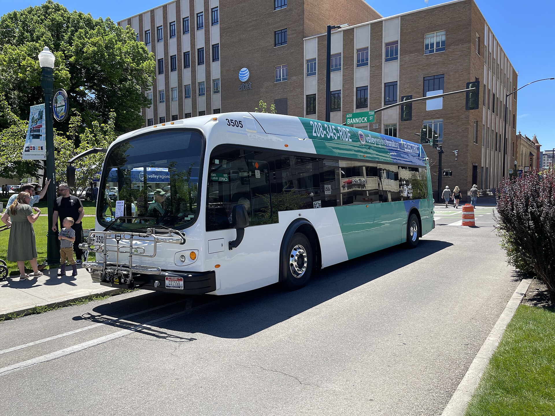
Valley Regional Transit (VRT) is the public agency that runs the fixed-route buses, paratransit, and vanpool programs across Ada and Canyon counties — the region generally called the Treasure Valley. It is not a city department of Boise alone; it is a regional authority, and its buses connect Boise to Meridian, Nampa, Caldwell, Garden City, Eagle, Star, and Kuna to varying degrees.
What kind of agency is Valley Regional Transit?
VRT is organized under Idaho’s public transportation authority law as a regional body, not as a Boise city department or a private operator. Its own site describes it as the designated public transportation provider for the Treasure Valley, covering both Ada County (Boise, Meridian, Eagle, Star, Kuna, Garden City) and Canyon County (Nampa, Caldwell, and surrounding communities). That regional scope is worth understanding on its own terms: it is a separate question from what a city border does, and readers comparing Boise, Meridian, and Eagle as distinct municipalities should note that VRT service levels differ sharply between them even though all three sit inside the agency’s territory.
VRT is also distinct from the Community Planning Association of Southwest Idaho (COMPASS), the region’s metropolitan planning organization. COMPASS produces long-range transportation and land-use plans for the valley; VRT is the operator that actually runs vehicles on the road. The two work together on projects like corridor studies, but they are different organizations with different roles, and VRT’s own site is the correct place to check current operating details rather than planning documents.
Where does the bus actually go?
VRT’s fixed-route network is concentrated in the Boise-Meridian-Nampa-Caldwell corridor along and near State Street, Fairview Avenue, Franklin Road, and the Interstate 84 corridor, with a smaller mesh of routes serving Garden City and parts of the Boise Bench. Service density is highest inside Boise city limits and thins out quickly toward the edges of the metro area — a pattern typical of mid-sized Western cities that grew up around the automobile rather than transit.
Within Boise, buses generally converge on a downtown hub before radiating outward, which means most cross-town trips involve a transfer downtown rather than a direct route between two neighborhoods. That structure matters for anyone trying to use the network rather than just look at a map — trips within a single corridor (say, along State Street or along Fairview) tend to work reasonably well; trips between two outlying neighborhoods often do not, at least not quickly.
Because route numbers, frequencies, and even branding have changed more than once in recent years, VRT’s own published system map and route list — not this article, and not a static description — is the only reliable source for what runs where today. Anyone planning a specific trip should check Valley Regional Transit’s own site before relying on it.
How do fares and passes work?
VRT operates on a flat-fare, cash-or-pass model rather than the zoned distance-based fares used by some larger metro systems. Riders can typically pay per boarding, buy a day pass, or buy a monthly pass, and VRT has offered a rechargeable fare card alongside cash payment. Because fare amounts and card programs are exactly the kind of detail that changes on the operator’s own schedule, this article deliberately does not quote a figure — VRT’s fare page is the place to confirm the current cost of a single ride, a day pass, or a monthly pass before traveling.
For residents who commute by bus regularly, the practical question is less “what does a ticket cost” and more “does a monthly pass make sense against how often I actually ride” — a calculation that only holds up if checked against VRT’s current published rates rather than an older figure repeated online.

Is there anything besides buses — rail, streetcar, anything fixed to tracks?
No. Boise has no operating light rail, streetcar, or commuter rail system, despite having a grand former railroad depot on the Bench. The Boise Depot is a historic Union Pacific passenger station, now used mainly for events and as a city-owned landmark rather than an active transit hub — a distinction covered in detail in coverage of the Boise Depot and Platt Gardens and in a broader look at what remains of Boise’s railroad history. Amtrak does not currently serve Boise with regular passenger rail. VRT’s buses are, at present, the entirety of the region’s fixed-route public transit.
A long-discussed project along State Street — sometimes described in COMPASS and VRT planning documents as a higher-frequency, higher-capacity transit corridor toward Eagle and Star — has been studied for years as a candidate for improved bus service or bus rapid transit. It has not, as of any general description here, been built out as a rail line, and readers wanting its current status should check COMPASS’s own planning pages rather than assume progress that may not have happened.
Does VRT serve Boise State University and the airport?
VRT routes run through central Boise near Boise State University’s campus, though the university also operates its own on-campus shuttle system separately from VRT’s regional routes — the two are not the same service, and a student or visitor should not assume a campus shuttle stop is a VRT stop or vice versa. Airport service, where it exists, is also worth confirming directly with VRT rather than assuming a route that once existed still runs on the same schedule; airport connections are exactly the kind of route detail that gets adjusted as demand and funding shift.
Who actually rides it, and does a visitor need to?
VRT ridership skews toward commuters without reliable access to a car, students, and residents making routine trips along the busier corridors — State Street, Fairview, Franklin, and the routes linking Boise to Meridian and Nampa. It is a genuine transit network, not a tourist shuttle, and it was not designed around downtown sightseeing.
For a visitor without a car, the honest answer is that VRT can cover some point-to-point trips within Boise reasonably well, particularly along the State Street corridor and into Garden City, the separate small city that sits along the Boise River northwest of downtown, but it is not built for the kind of multi-stop museum-and-landmark day that many visitors want. A broader, more direct answer to the underlying question sits in Access Boise’s own look at whether you need a car in Boise, which weighs the bus network against walking, biking, and driving across the city’s actual layout.
How does the bus relate to how Boise is actually laid out?
Boise’s street grid runs largely on a directional logic tied to the Boise River and the base-and-meridian survey system, a pattern explained in detail in a piece on how Boise is laid out and which way its streets run. VRT’s busiest corridors track that grid closely — State Street, Fairview, and Franklin are all major arterials as well as bus corridors — which is one reason the network works better for trips along those lines than across them.
Downtown itself functions as the network’s practical center of gravity even though its formal boundaries are a separate question, covered in a piece on where downtown Boise actually begins and ends. Understanding that boundary helps explain why so many VRT routes pass through the same few downtown blocks regardless of where they start or end.
What should a resident actually take away from this?
For someone living in Boise full-time, VRT is a useful supplement to a car rather than a full replacement for one in most neighborhoods — a reality echoed across broader coverage of what it is actually like to live in Boise. It is most useful for a predictable daily commute along a well-served corridor, less useful for spontaneous or cross-town trips, and worth pairing with the city’s bike infrastructure and walkable core neighborhoods rather than relying on alone.
Anyone building an actual transit-dependent routine in the city — checking real-time arrivals, comparing monthly pass costs, or tracking route changes — should treat VRT’s own site as the primary source, and treat general city writing, including this article, as background rather than a live timetable. Further reading on how the city moves, block by block, sits in the Getting Around archive.
Access Boise is an independent guide written from published, checkable sources. We have not visited the places described here and we do not publish personal recommendations or invented ‘local favourites’ — where something is singled out as notable, we say who says so. Opening times, fares, closures and prices change at short notice, so treat everything here as a starting point and confirm with the museum, operator or venue directly before building a day around it. We give no advice on visas, insurance, health or safety; use your own government’s official guidance for those.
Featured image: Photo by Ac530, source, CC BY 4.0
