The East End is the residential district immediately east of downtown Boise, running from the edge of downtown along the Boise River toward the foothills and the grounds of the Old Idaho Penitentiary. It is defined less by a single landmark than by a corridor: river on one side, hillside on the other, and a mix of historic streets, parkland and institutional sites strung between them.
What is the East End of Boise?
The East End is one of Boise’s recognized neighborhoods, sitting east of the downtown core and south of the foothills bench. It takes in Warm Springs Avenue, Fort Street, and the land around the Old Idaho Penitentiary and Idaho Botanical Garden, with the Boise River and its Greenbelt path forming much of its southern edge. It is a residential area first, with a scatter of historic and civic sites rather than a commercial strip.
Where are its boundaries?
Boise’s neighborhood associations, recognized by the city, define boundaries for planning and outreach purposes rather than as legal districts. The East End Neighborhood Association’s territory runs roughly from the eastern edge of downtown out to the foothills and the penitentiary grounds, bounded to the south by the Boise River. For a reader trying to place it on a map, it is the wedge of the city that sits between the North End’s grid of tree-lined streets and the open hillside marked by Boise’s own hillside letters. Anyone comparing the two should also read what makes the North End look the way it does.
What is Warm Springs Avenue, and why does it matter here?
Warm Springs Avenue is the East End’s best-documented historic corridor. Its houses, many dating to the late 19th century, were among the first in the country to be heated by piped geothermal water, drawn from local hot springs starting in the 1890s. Sections of the avenue are recognized as a historic district, and several individual homes appear in surveys tied to the National Register of Historic Places. The street’s significance rests on that early geothermal system rather than on any single building, which is why it reads today as a continuous run of well-kept older houses rather than a single attraction.
What does the Old Idaho Penitentiary add to the neighborhood?
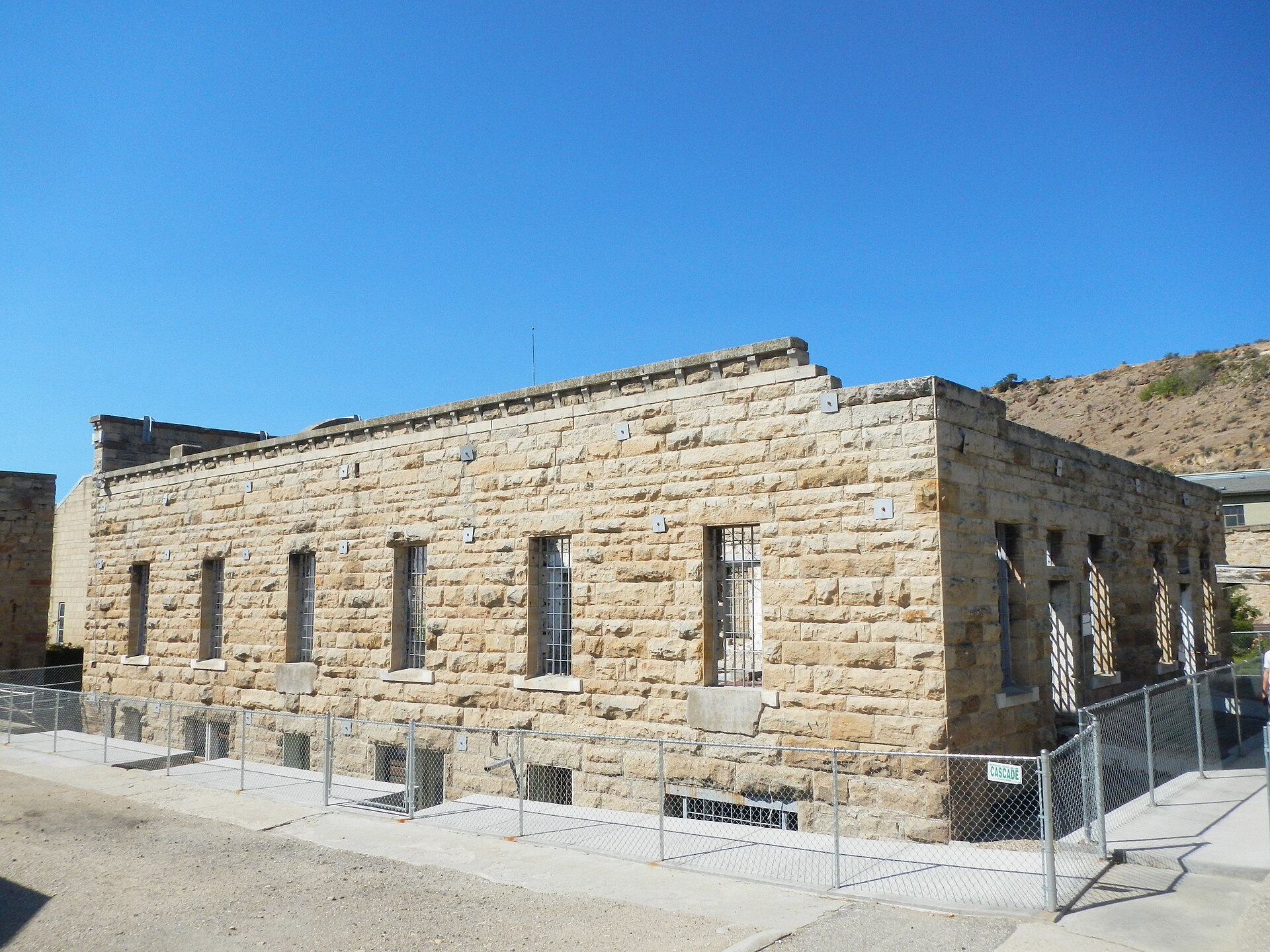
The Old Idaho Penitentiary sits at the eastern end of the East End, on the bench below Table Rock. It operated as Idaho’s territorial and state prison from the 1870s until 1973 and is now a historic site interpreted by the Idaho State Historical Society. Its own visitor information covers the cellblocks, the roses planted by inmates in the old rose garden, and the site’s later use for tours and events. A full account of the site’s history and current visiting arrangements is covered separately in this guide to the Old Idaho Penitentiary.
Immediately next to the penitentiary, on land that was once part of the prison’s own farm and grounds, sits the Idaho Botanical Garden. Its themed gardens and seasonal displays occupy what was working penitentiary acreage, a relationship explained in more detail in the piece on the Idaho Botanical Garden and the old penitentiary grounds.
.jpg)
What is Fort Boise’s role in the East End?
Fort Boise was established in 1863 as a U.S. Army post at the eastern edge of the young city, intended to keep watch over the Oregon Trail route and the surrounding mining traffic. The military reservation was gradually reduced over the following decades as the city grew around it. Land from the old fort now forms Fort Boise Community Park, a city-run park with sports fields and a community center, and the fort’s presence is one reason the East End’s street pattern and public land holdings differ from the more uniformly platted North End.
How does the Boise River and Greenbelt shape the district?
The Boise River Greenbelt, the paved multi-use path that follows the river through the city, runs along the East End’s southern edge. It links the neighborhood to Municipal Park, to the river-adjacent stretch used by anglers and cyclists, and westward toward downtown and the Boise Depot area. The Greenbelt is maintained by the city of Boise as part of its parks system, and its presence along this stretch is one reason the East End functions as a walking and cycling route between downtown and the foothills trailheads rather than only as a residential pocket.
How does the East End connect to downtown and the foothills?
Geographically, the East End is the hinge between two things the city is best known for: its compact downtown grid and its foothills trail network. Capitol Boulevard and the streets radiating from downtown feed directly into the neighborhood’s western edge; the district on Capitol Boulevard’s own role in the city is covered in what Capitol Boulevard connects. To the north and east, streets climb toward the bench and the foothills, where Boise’s Ridge to Rivers trail system takes over. Table Rock, the mesa overlooking the penitentiary grounds, and the hillside letters above the city are both reachable from this side of Boise, and both are described in their own entries on Table Rock and what sits on top of it and the hillside letters above the city.
What is it like to live in the East End?
For residents, the East End reads as a quieter, more residential counterpart to downtown, with older housing stock, mature trees along streets like Warm Springs, and direct Greenbelt access that many use for a daily commute into downtown by bike or on foot rather than by car. Its geothermal heating history is not purely historical either — the same municipal geothermal system that warms parts of downtown Boise draws on wells in this part of the city, a detail that connects the neighborhood’s 19th-century engineering to its present-day utilities. Proximity to the foothills trailheads also means residents here have some of the shortest walks in the city to Ridge to Rivers trail access points, a point covered generally in the guide to living in Boise.
What should a visitor plan to see here?
A visitor treating the East End as a destination in itself would typically combine the Old Idaho Penitentiary and the Idaho Botanical Garden, since they sit on adjoining land, with a walk or ride along the Greenbelt back toward downtown. Warm Springs Avenue rewards a slow drive or ride rather than a stop, since its value is in the run of historic houses rather than a single site open to the public. None of the East End’s residential streets are set up for casual visiting in the way a museum or park is, so the practical approach is to treat the penitentiary and garden as the anchor and the neighborhood itself as the route between them and downtown. General planning notes on getting around the city, including how districts like this one connect by foot, bike, and road, are covered in the practical guide to Boise, and a broader index of the city’s neighborhoods, landmarks and museums sits in the main Boise guide and the site’s neighborhoods archive.
Access Boise is an independent guide written from published, checkable sources. We have not visited the places described here and we do not publish personal recommendations or invented ‘local favourites’ — where something is singled out as notable, we say who says so. Opening times, fares, closures and prices change at short notice, so treat everything here as a starting point and confirm with the museum, operator or venue directly before building a day around it. We give no advice on visas, insurance, health or safety; use your own government’s official guidance for those.
Featured image: Photo by Eric Friedebach, source, CC BY 3.0
