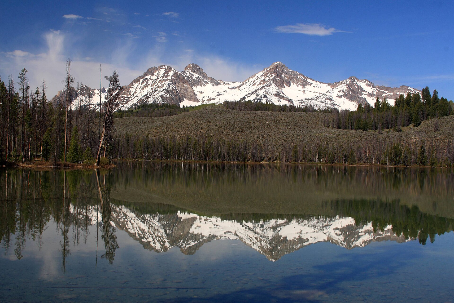
The Sawtooth Mountains are a range of granite peaks in central Idaho, roughly 100 miles northeast of Boise as the crow flies and considerably more by road. They are not a single mountain or a park in the strict sense — they are a mountain range, most of it protected inside the Sawtooth National Recreation Area, with the town of Stanley functioning as the practical starting point for almost everyone who visits.
What exactly is the Sawtooth Range?
It is a chain of more than 40 peaks exceeding 10,000 feet, cut into sharp, tooth-like ridgelines by glaciers rather than volcanic action, which is why the skyline reads so differently from the rounder foothills directly behind Boise. The range sits within the Sawtooth National Forest and is bordered by the Salmon River basin to the north and the Sun Valley area to the southeast.
At its core is the Sawtooth Wilderness, a federally designated wilderness area of roughly 217,000 acres where no motorized or mechanized travel is permitted — no vehicles, no bikes, nothing with a wheel. That designation, and the surrounding Sawtooth National Recreation Area around it, are both managed by the U.S. Forest Service, whose own site for the area lays out current conditions, permit rules for the wilderness interior, and seasonal closures.
How far is it from Boise, and is it a day trip?
It is a long day trip at best, and most people treat it as an overnight. The drive from Boise to Stanley, the range’s gateway town, runs close to three hours depending on route and season, and that is before doing anything once there. Anyone weighing this against a shorter outing should compare it with closer options like Lucky Peak, which sits along one of the routes out of the city.
There are two realistic ways to drive it, and they are genuinely different trips.
- Highway 21, the Ponderosa Pine Scenic Byway — north out of Boise through the foothills, past the reservoir at Lucky Peak, through Idaho City, and on through Lowman before climbing into the mountains and dropping into Stanley from the south. This is the more direct route in mileage and the one most locals describe as the “back way in.”
- Via Ketchum and Highway 75 — south on Interstate 84 or Highway 21 toward the Wood River Valley, through the Ketchum and Sun Valley area, then north on Highway 75 (itself a designated scenic byway) along the Salmon River into Stanley from the south-southeast.
Both routes cross mountain passes and are subject to winter closures, chain requirements, and rockfall or wildfire-related detours. Idaho’s official road-condition reporting, run through the Idaho Transportation Department, is the source to check before either drive rather than relying on general mapping apps, which do not reliably reflect seasonal closures at elevation.
Who manages the Sawtooth National Recreation Area, and what does that mean for a visitor?
The Sawtooth National Recreation Area (SNRA) was established by Congress in 1972 specifically to protect the Sawtooth Valley and the range from mining and subdivision pressure, and it is administered by the U.S. Forest Service. Its own visitor information — trail conditions, campground status, wilderness permit requirements — is published through the Forest Service’s Sawtooth NRA pages, and that is the authoritative source for anything time-sensitive, including whether a particular trailhead or campground is open.
Inside the SNRA, a smaller area — the Sawtooth Wilderness itself — carries stricter rules. Overnight stays inside the wilderness boundary generally require a permit obtainable at trailhead self-registration stations, and group size limits apply. None of this is enforced casually; the Forest Service treats the wilderness designation as a legal boundary, not a suggestion.
What is Stanley, and why does almost every trip pass through it?
Stanley is a small town at the junction of Highway 21 and Highway 75, sitting at roughly 6,260 feet in the Sawtooth Valley directly beneath the peaks. It is not a resort town in the way Sun Valley is; it functions as the supply point, ranger station location, and junction for anyone heading into the range, whether that means a day hike, a multi-day wilderness trip, or simply driving through toward the Salmon River country further north.
The Stanley Ranger District office, part of the Sawtooth NRA administration, is the place the Forest Service itself directs visitors to for current trail and fire information specific to the immediate area — a more reliable source than word of mouth for anything that changes week to week, including trail washouts and active wildfire smoke.


What is Redfish Lake, and is it the obvious first stop?
Redfish Lake is the largest and most visited lake in the SNRA, sitting a short drive south of Stanley directly beneath the range’s most photographed peaks. It has a Forest Service visitor center, developed campgrounds, and a lodge operated under a Forest Service concession agreement — meaning the lodge itself is privately run but on federal land under a permitted arrangement, which is why its facilities and season are separate from the Forest Service’s own trail and permit information.
For a first visit with limited time, Redfish Lake is the single most commonly cited starting point in Forest Service materials themselves, largely because it has the visitor center, boat access, and several trailheads in one place — not because it is the only lake worth reaching.
When does the range actually open up?
High passes and many trailheads carry snow well into early summer, and the SNRA’s own seasonal notices typically describe full access — meaning most campgrounds, the visitor center, and higher trailheads — as a mid-to-late-summer proposition, with a working window roughly from late June through September depending on snowpack. Winter closes most vehicle access to higher elevations entirely, though Stanley itself remains reachable and is used as a base for cross-country skiing and snowmobiling by those equipped for it.
Wildfire smoke is a genuine late-summer factor across central Idaho, including this range, and it is worth checking current air quality alongside road conditions before a late-July or August trip.
Does wildlife or terrain require any particular caution?
This site does not offer safety advice, but it is worth noting that Idaho Fish and Game publishes species information and general guidance for the backcountry areas of the state, including bear awareness relevant to much of the Sawtooth backcountry, and that is the correct authority to consult directly rather than informal trip reports.
How does this fit against Boise’s other mountain trips?
Boise sits close to several distinct mountain destinations that are easy to conflate. The Sawtooths are a different proposition from the city’s own foothills system — covered in detail in the Parks & Foothills archive — and from closer day trips like McCall, which sits in a different range entirely, west of the Sawtooths via Highway 55. Anyone building a longer Idaho itinerary around Boise is generally better served treating the Sawtooths as their own overnight trip rather than folding them into a single busy day.
For planning the logistics side — road conditions, seasonal timing, what belongs in a single day versus what needs a night away — the Boise practical hub and the Day Trips archive cover the comparable range of options out of the city, and the Boise guide hub is the starting point for what the city itself holds before heading out to the mountains at all.
Access Boise is an independent guide written from published, checkable sources. We have not visited the places described here and we do not publish personal recommendations or invented ‘local favourites’ — where something is singled out as notable, we say who says so. Opening times, fares, closures and prices change at short notice, so treat everything here as a starting point and confirm with the museum, operator or venue directly before building a day around it. We give no advice on visas, insurance, health or safety; use your own government’s official guidance for those.
Featured image: Photo by Frank Kovalchek, source, CC BY 2.0
