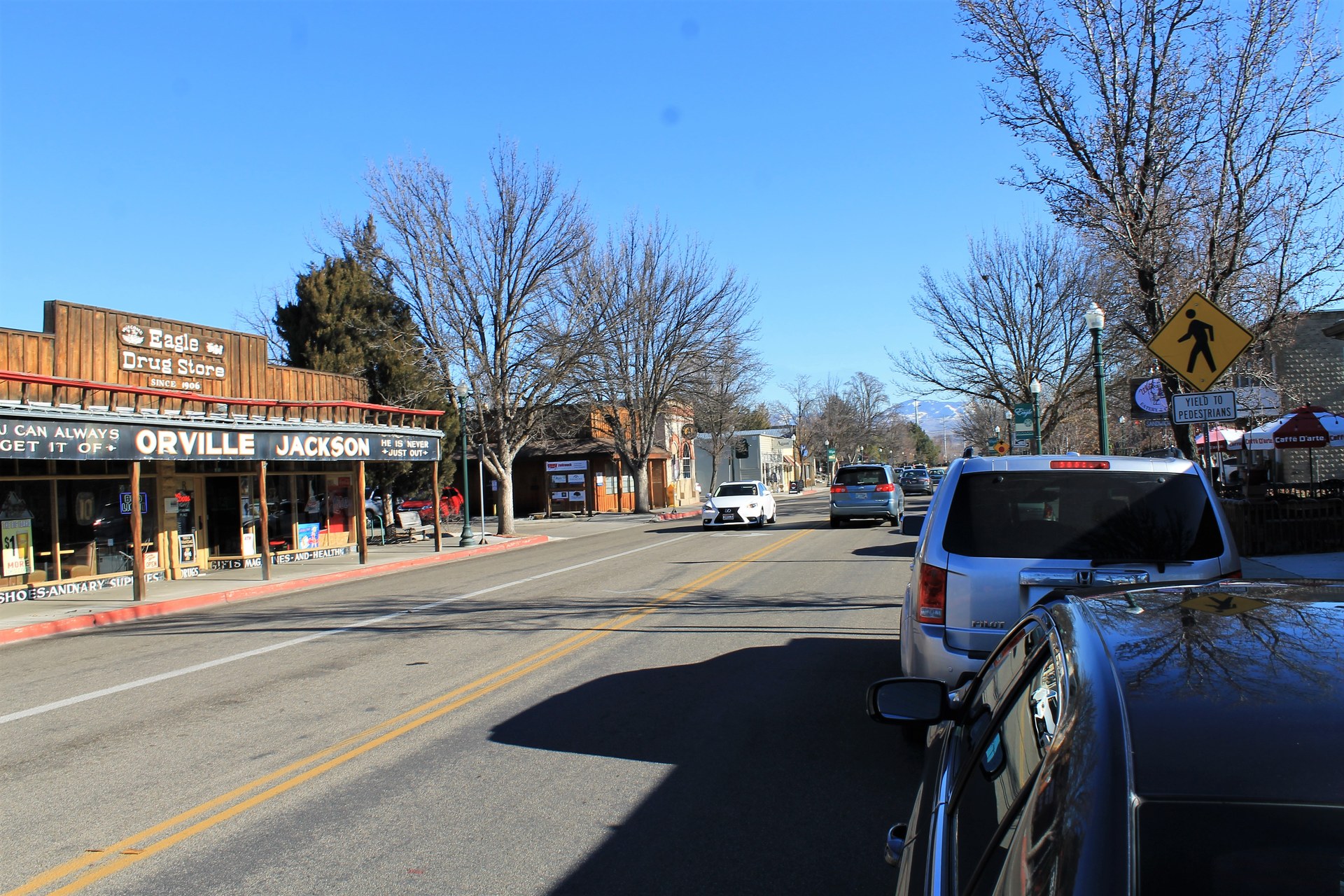
Eagle, Idaho is an incorporated city in Ada County, immediately northwest of Boise, on the north side of the Boise River. It is one of the fastest-growing cities in the Boise metropolitan area, built largely on suburban subdivisions, and it functions today as a bedroom community with its own city government, school feeder pattern, and a small historic downtown along State Street.
Where Is Eagle, and How Does It Relate to Boise?
Eagle sits along Idaho State Highway 44, roughly eight miles northwest of downtown Boise, on the opposite bank of the Boise River from Garden City. It is one of several cities that ring Boise inside Ada and Canyon counties, alongside Meridian to the south and Star further west. Eagle has its own city council and mayor and is legally distinct from Boise, though the two are functionally continuous — commuting between them on State Street or the Eagle Road corridor is routine, and there is no visible break in development at the city line.
For a broader look at how Eagle, Meridian, and Boise divide up the valley, the comparison is covered in more detail in how Boise, Meridian, and Eagle differ.
How Did Eagle Get Its Name and Grow Into a City?
The Idaho State Historical Society’s records on the area trace the settlement to a 19th-century ferry crossing on the Boise River, near a large cottonwood tree said to have held an eagle’s nest, which gave the crossing point — and later the town — its name. The community grew slowly through the early 20th century as an agricultural service town for the surrounding farmland before formally incorporating as a city.
The pace of change accelerated sharply from the 1990s onward, as Boise’s growth pushed subdivisions and commercial development north and west along the river valley. The U.S. Census Bureau’s population estimates place Eagle among the higher-growth municipalities in Idaho over the past two decades, a pattern consistent with the wider expansion of the Treasure Valley documented in coverage of neighboring cities like Nampa and Caldwell.
What Does Downtown Eagle Actually Look Like?
Eagle’s historic core runs along State Street near its intersection with Eagle Road, a compact stretch of older commercial buildings, the city’s civic offices, and a public park system that follows the Boise River greenbelt through town. This original townsite is small relative to the city’s overall footprint; most of Eagle’s population lives in subdivisions built outward from that core over the past thirty years, many organized around golf courses and river-adjacent green space.
The city’s own government site is the authoritative source for current civic information, park listings, and municipal services, since local details of this kind change on a timescale a static guide cannot track reliably.

What Is Eagle Island State Park?
Eagle Island State Park is a state park managed by the Idaho Department of Parks and Recreation, located on an island formed by the Boise River just south of the city. The department’s own site describes the park’s river-based recreation, including a developed swimming area, boat access, and multi-use trails, making it one of the more significant public recreation sites tied directly to Eagle rather than to Boise proper.
Because the park sits on the Boise River, it connects loosely to the same river system covered in guides to the Boise River Greenbelt and to river-based recreation closer to the city center, such as Quinn’s Pond and Esther Simplot Park, though Eagle Island is a separate, state-run facility with its own access points and its own posted rules.
How Is Eagle Different From Boise, Meridian, or Garden City?
Eagle is smaller and considerably less dense than Boise, with a land-use pattern dominated by single-family subdivisions rather than a downtown core, apartments, or the kind of institutional density found around Boise State University or the North End. It has its own zoning authority, its own comprehensive plan, and a separate school-district relationship, even though many residents commute into Boise for work.
Compared with Garden City — the small, industrial-turned-creative municipality that sits between Boise and Eagle along the river — Eagle is residential and largely built after 1990, while Garden City retains an older mix of light industry, warehouses, and river frontage. Compared with Meridian, Eagle is smaller and more oriented around the river than around a retail corridor. The practical difference for a visitor or a new resident is mostly about density and purpose: Boise is the employment and cultural center of the valley, Meridian and Eagle are largely residential growth cities around it.
What Is Eagle Like to Live In?
For residents, Eagle functions as a car-dependent suburb with its own city services, parks, and school attendance zones, connected to Boise by a limited number of arterial roads — chiefly State Street and Eagle Road — that carry heavy commuter traffic at peak times. Valley Regional Transit, the region’s public bus operator, provides limited service into Eagle, but the city was not built around transit and most daily movement assumes a car.
Housing costs in Eagle have historically run above the Boise-area median, a pattern tied to its newer subdivisions, larger lot sizes, and river- or golf-course-adjacent developments; current figures should be checked against Ada County or realtor association data rather than assumed. Anyone weighing whether to live in Eagle versus closer to downtown Boise is really weighing a quieter, newer, car-oriented suburb against the density, walkability, and cultural access covered in what it is actually like to live in Boise.
Is Eagle Worth a Visit From Boise?
Eagle is not a tourist destination in the way that downtown Boise’s museums or the Basque Block are; its public draw is largely outdoor and river-based, centered on Eagle Island State Park and the greenbelt corridor. Visitors based in Boise who want to see Eagle are typically combining it with a river outing or a drive along State Street rather than planning a dedicated day around the city itself.
Those planning that kind of outing may find it more useful to start from the broader logistics covered in Boise’s practical planning guide or to browse other river- and park-based day trips in the day trips archive, since Eagle Island fits that pattern more than it fits a landmark-by-landmark sightseeing list. For context on how Eagle sits within the wider set of Boise-area neighborhoods and satellite cities, the neighbourhoods archive covers the comparable pattern in Garden City, the Bench, and other named districts around the valley.
Access Boise is an independent guide written from published, checkable sources. We have not visited the places described here and we do not publish personal recommendations or invented ‘local favourites’ — where something is singled out as notable, we say who says so. Opening times, fares, closures and prices change at short notice, so treat everything here as a starting point and confirm with the museum, operator or venue directly before building a day around it. We give no advice on visas, insurance, health or safety; use your own government’s official guidance for those.