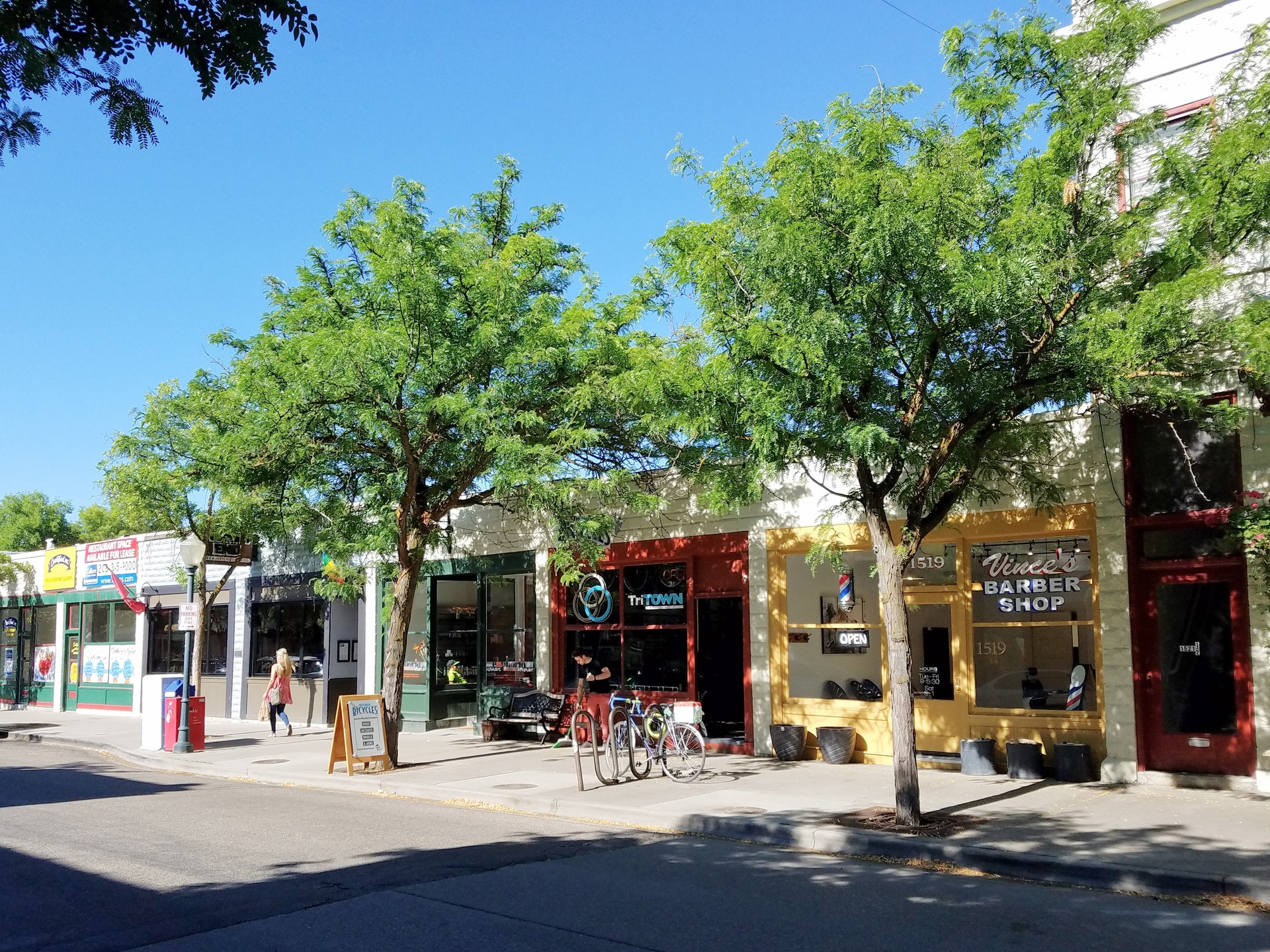
The North End is Boise’s oldest residential neighborhood north of downtown — a grid of tree-lined streets built mostly between the 1890s and the 1930s as the city’s first streetcar suburb. It looks the way it does because it was platted, wired for a trolley line, and built out lot by lot before zoning separated homes from shops, which is why houses and a small commercial strip still sit within walking distance of each other today.
Where is the North End, and what are its boundaries?
The North End sits directly north of Boise’s downtown core, climbing gently from the city grid toward the foothills. It is bounded roughly by Hill Road on the north, where the built city meets open foothills terrain, and by the downtown grid and State Street area to the south. Its east and west edges blur into surrounding neighborhoods rather than following a single clean line — a pattern typical of how the city of Boise’s own neighborhood association program defines its many recognized districts, by long-standing local usage as much as by surveyed boundary.
Within that area, the neighborhood is organized around a set of numbered streets running roughly north–south, crossed by named streets running east–west — the same basic grid logic as downtown Boise, extended uphill as the city grew.
Why was the North End built as a streetcar suburb?
Boise operated an electric streetcar system starting in the early 1890s, and one of its lines ran north from downtown along 13th Street into what is now the North End, continuing service into the late 1920s according to Idaho State Historical Society reference material on the city’s early transit history. That line is the reason the neighborhood exists in the form it does: it let people live north of the business district and still commute downtown daily, decades before the private automobile made that unremarkable.
Development followed the line. Lots were platted and sold in stages as the trolley extended, which is why the North End reads less like a single planned subdivision and more like several waves of building stacked one on top of the next — modest worker cottages near the older, southern end of the grid, larger period-revival houses further out where development came later and lots were pricier.
Why do the houses look the way they do?
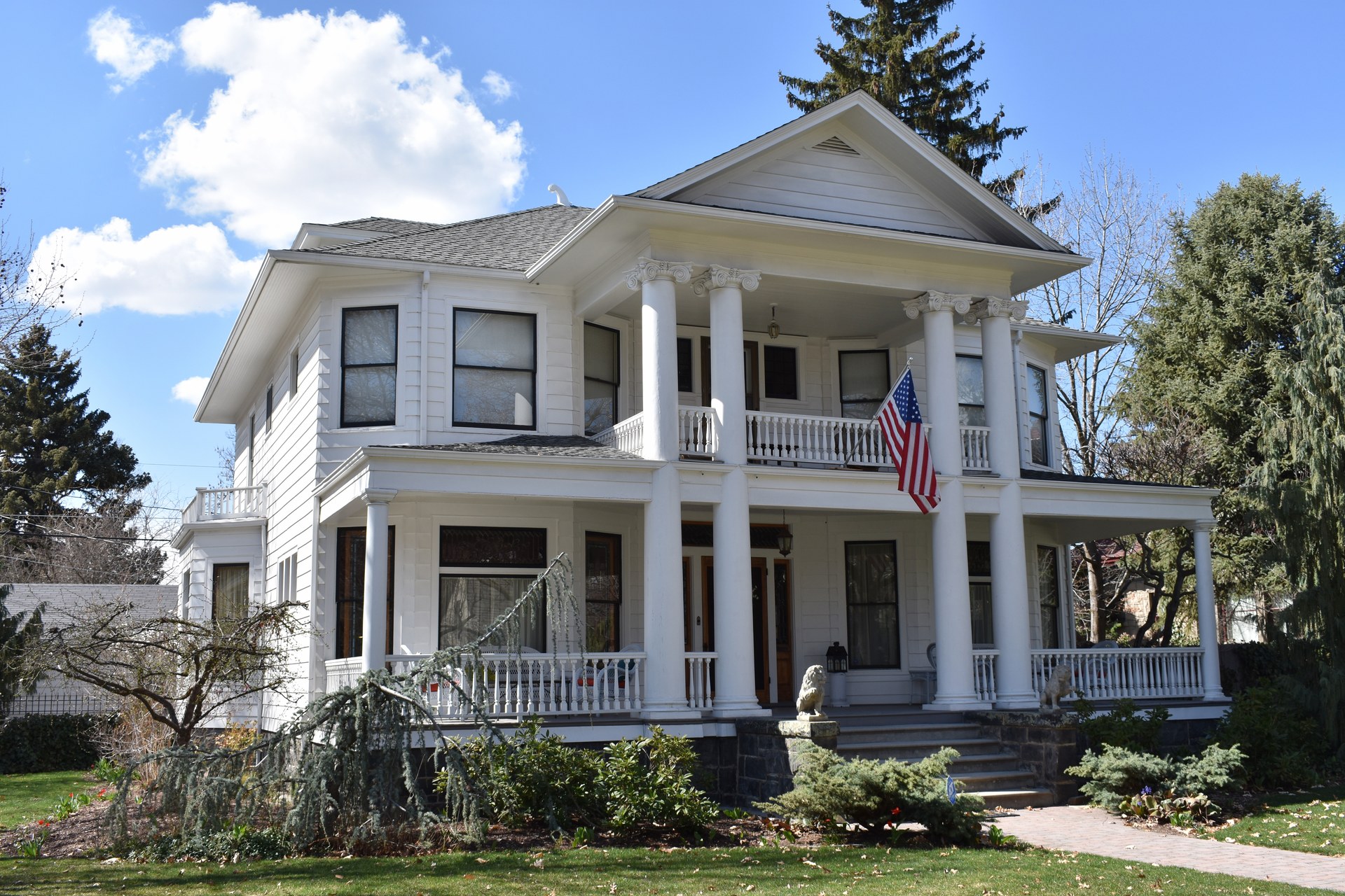
The North End’s housing stock spans roughly four decades of American residential architecture, largely intact: Queen Anne and Folk Victorian homes from the 1890s, American Foursquare and Craftsman bungalows from the 1900s–1920s, and Tudor Revival and Colonial Revival houses from the 1920s and 1930s. That range exists because the neighborhood was built continuously rather than in one development push, with each decade’s prevailing style filling in whatever lots were still open.
Much of this stock survives because Boise’s own historic preservation program and local district designations have discouraged large-scale teardown-and-rebuild redevelopment in parts of the neighborhood — a policy tool distinct from, but related to, the protections that come with National Register of Historic Places listing.
What is Hyde Park, and why is it there?
Hyde Park is the North End’s small historic commercial strip, centered on 13th Street, and it exists precisely because that street once carried the streetcar line. A trolley stop needed shops clustered around it, and those early-1900s commercial buildings — a mix of storefronts built to serve a walking, transit-riding neighborhood rather than a driving one — still stand and still function as the district’s retail core. The Hyde Park Historic District is listed on the National Register of Historic Places, a designation that recognizes the intact early-20th-century commercial streetscape rather than any individual business inside it.

What is Harrison Boulevard, and how is it different from the rest of the North End?
Harrison Boulevard is a wider, landscaped street running through the neighborhood, lined with larger period-revival houses built mostly in the 1920s and 1930s, and it forms its own National Register-listed historic district, separate from the surrounding grid. It was laid out as a boulevard in the City Beautiful planning tradition common to American cities of that era — a wide, tree-planted corridor meant to read as a civic amenity in itself, not just a route between two points, in contrast to the plainer numbered streets around it.
How does the North End connect to the foothills?
The neighborhood’s northern edge runs directly against Boise’s undeveloped foothills, and several formal trail access points sit inside or at the edge of the North End itself. Camel’s Back Park, a city park at the base of the foothills, functions as one of the more heavily used trailheads into the Ridge to Rivers system, the city of Boise’s own foothills trail network. From trails near there, hikers can reach terrain that connects toward landmarks covered elsewhere on this site, including Table Rock and the hillside letters above the city, both visible from parts of the neighborhood on a clear day.
That direct line from residential street to open foothills is not incidental — it is one of the reasons the North End has consistently been described, in the city’s own planning and parks material, as a neighborhood built with foothills access in mind rather than added later.
Is the North End’s grid connected to Boise’s railroad and streetcar history more broadly?
Yes, though the two are often confused. The streetcar line that shaped the North End was a separate, in-city system from the mainline railroad that brought the Boise Depot and its era of long-distance rail travel to the city. Readers interested in how the city’s rail-era infrastructure has survived, and what has been repurposed or lost, can find that history laid out in a companion piece on what remains of Boise’s railroad history today.
What is the North End like to live in today?
It functions, in practical terms, as one of Boise’s most walkable older neighborhoods: a residential grid with a compact commercial node, direct trail access, and a housing stock old enough to have individual character rather than uniform floor plans. That combination has made it consistently sought-after, which shows up in higher property values relative to much of the rest of the city — a pattern noted in local real estate and planning commentary rather than something this site can independently verify or quantify.
The neighborhood is represented by an active, city-recognized neighborhood association, one of several dozen such associations across Boise, and residents engage regularly with the city on zoning and infill questions — a live tension in a district where much of the appeal rests on a housing stock built before current density expectations existed. For a broader look at how Boise’s neighborhoods function day to day, the living in Boise hub covers that ground in more general terms, while the Boise guide hub situates the North End among the city’s other districts and landmarks.
Readers researching the neighborhood’s built environment in more depth can also work through the site’s landmarks and sights archive for individual buildings and districts, and the parks and foothills archive for the trail network the neighborhood backs onto.
Access Boise is an independent guide written from published, checkable sources. We have not visited the places described here and we do not publish personal recommendations or invented ‘local favourites’ — where something is singled out as notable, we say who says so. Opening times, fares, closures and prices change at short notice, so treat everything here as a starting point and confirm with the museum, operator or venue directly before building a day around it. We give no advice on visas, insurance, health or safety; use your own government’s official guidance for those.