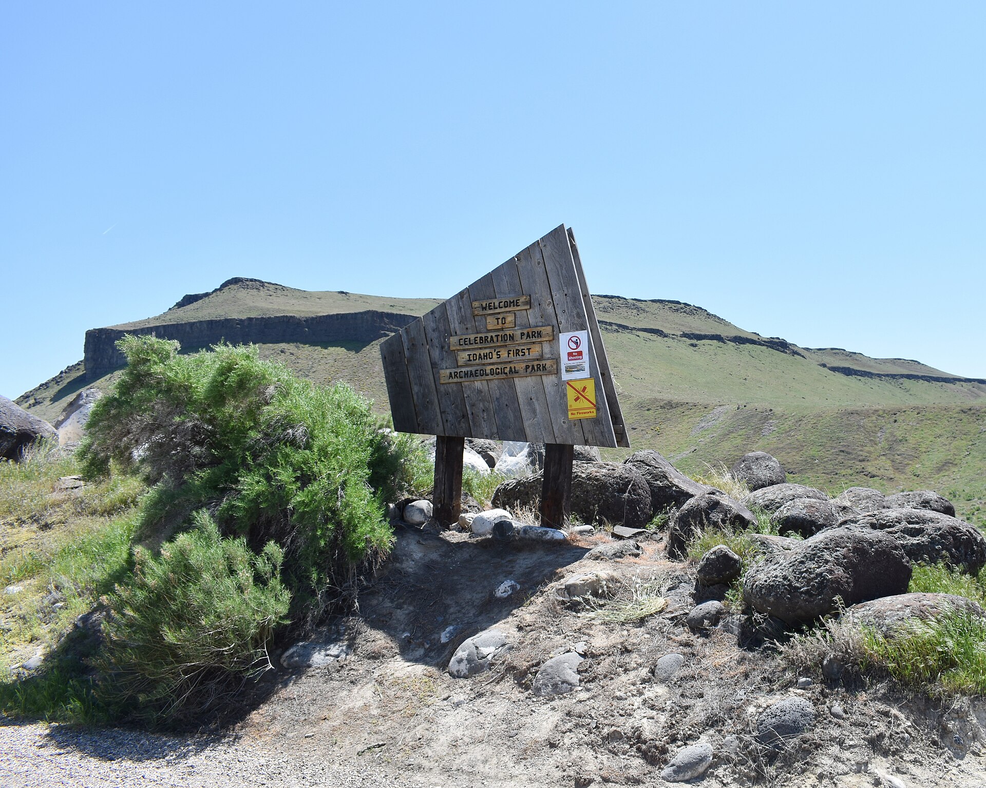
Celebration Park is Idaho’s only designated archaeological park, a stretch of Snake River canyon near Melba, in Canyon County, roughly 30 miles southwest of Boise. It protects basalt boulders carved with Native American petroglyphs, a historic railroad bridge, and evidence of a prehistoric flood that shaped the land the carvings sit on.
What is Celebration Park?
Celebration Park is a county-run park along the Snake River, established to preserve a concentration of rock art and other archaeological evidence in one place. It is managed by Canyon County’s Parks, Recreation and Waterways Department, which operates it as a heritage site rather than a conventional recreation park — there is no swimming beach or playground focus here, the point of the site is what is carved into the rock.
The park sits within the Snake River Birds of Prey National Conservation Area, a large tract of public land managed by the Bureau of Land Management for raptor habitat, which explains why the surrounding canyon feels remote and undeveloped rather than landscaped. For context on how this fits into a wider day out from Boise, the Day Trips archive covers several similar sites within a short drive of the city.
Where is Celebration Park, and how do you get there?
Celebration Park is located off the Snake River, near the town of Melba, in Canyon County. It is generally described as a 45-minute to hour-long drive southwest of downtown Boise, most of it on county roads once you leave the highway.
There is no public transit route to the park, and no rideshare density this far out — a private vehicle is the only practical way to reach it. That makes it a good example of a broader pattern covered in Do You Need a Car in Boise?, and its distance is worth weighing against other options discussed in How Far Apart Is Everything in Boise? before planning a full day around it.
What is carved on the rocks at Celebration Park?
The carvings are petroglyphs — images pecked or incised into the dark, weathered surface of basalt boulders — showing animal figures, human-like forms, geometric and abstract patterns, and what researchers describe as symbolic designs whose meaning is not fully known. The Idaho State Historical Society, which has documented the site, attributes the images to Native peoples who used the canyon over a very long span of time, not a single culture or era.
The boulders themselves are not ordinary river rock. Canyon County’s own park materials describe them as fragments scattered across the canyon floor by the Bonneville Flood, a catastrophic prehistoric outburst flood that tore through the Snake River Plain roughly 14,500 to 17,000 years ago, according to geological research cited by the Idaho State Historical Society. The flood exposed and deposited the dark basalt surfaces that later became a canvas.
How old are the petroglyphs, and who made them?
Researchers do not attribute a single date to the carvings. The Idaho State Historical Society describes the rock art as accumulating over a period spanning thousands of years, made by successive groups of Native peoples whose descendants include the Shoshone-Bannock and Northern Paiute tribes of the region. Because different images were carved at different times, using different techniques and levels of weathering, archaeologists read the site as a long record rather than one event.
This is part of why the wider area — often referenced in archaeological literature as the Wees Bar Petroglyph District — carries recognition on the National Register of Historic Places, the federal government’s official list of places significant in American history, culture, or archaeology, maintained by the National Park Service.
.jpg)
What else is at the park besides the petroglyphs?
The most visible non-geological feature is the Guffey Bridge, a historic railroad swing-span bridge originally built in 1897 for the Oregon Short Line Railroad and later relocated to this crossing of the Snake River. It now carries only foot and bicycle traffic, connecting the park to trails on the far bank, and is itself listed on the National Register of Historic Places.
Canyon County’s park materials also note wagon ruts and other traces associated with the historic Oregon Trail corridor nearby, reflecting the canyon’s later use as a river crossing point for westbound travelers — a much more recent layer of history laid over ground that had already been marked by people for thousands of years.
Is there a visitor center, and can you walk the site on your own?
Canyon County operates a seasonal visitor center at the park with interpretive exhibits explaining the petroglyphs, the flood geology, and the bridge’s history. Staffing and open days vary by season, so the county’s own site is the correct place to confirm current hours before a visit.
The petroglyphs themselves sit along a self-guided interpretive trail at the base of the canyon bluff, viewable from a marked path without needing a guide. Visitors are asked not to touch or approach the carved surfaces directly — basalt petroglyphs are irreversibly damaged by skin oils and contact, and the site is protected under state and federal archaeological resource laws, which make removing, touching, or defacing the carvings a legal offense, not just a courtesy request.
What should a visitor know before going?
- There is no shade along most of the canyon trail; exposure is significant in summer, and the region’s dry, high-elevation climate is covered in more general terms at Boise Elevation and Dry Air, Explained.
- Rattlesnakes are present in this canyon habitat, as they are across much of the Snake River Plain; standard outdoor caution applies, and Idaho Fish and Game’s own wildlife guidance is the relevant source for regional wildlife behavior.
- Parking or entry fees, where they apply, are set and changed by Canyon County directly — confirm current figures on the county’s own parks page rather than relying on a fixed number here.
- Cell coverage in the canyon is inconsistent; downloading directions before leaving Boise is more reliable than navigating live.
Is Celebration Park worth treating as a day trip from Boise?
It functions as a half-day stop rather than a full day out on its own, since the interpretive trail is short and there are no facilities beyond the visitor center. Many visitors pair it with other stops in the Snake River Canyon area or treat it as a single, focused outing built specifically around the rock art and the bridge.
For comparison, other archaeological and geological day trips from Boise are covered in What Is Bruneau Dunes State Park?, which sits farther south, and in What Is Idaho City, and What Is Left of the Gold Rush?, which covers a very different kind of historic site — mining rather than rock art — in the opposite direction from the city.
How does Celebration Park fit into the wider Boise area?
Boise’s own landmark inventory leans heavily on 19th- and 20th-century sites — the Basque Block, the Old Idaho Penitentiary, the Capitol building. Celebration Park sits outside that pattern entirely: it predates all of it by thousands of years and sits on land the city itself never touched. It is a reminder that the Treasure Valley’s human history did not begin with the Oregon Trail or the founding of Boise in 1863, but stretches back through a much longer, less documented record carved directly into stone.
Readers assembling a broader picture of what the region actually holds, beyond the city center, will find related context in the Boise Guide hub and in the Landmarks & Sights archive, both of which cover sites that, like this one, are defined by what they preserve rather than by any manufactured experience around them.
Access Boise is an independent guide written from published, checkable sources. We have not visited the places described here and we do not publish personal recommendations or invented ‘local favourites’ — where something is singled out as notable, we say who says so. Opening times, fares, closures and prices change at short notice, so treat everything here as a starting point and confirm with the museum, operator or venue directly before building a day around it. We give no advice on visas, insurance, health or safety; use your own government’s official guidance for those.
Featured image: Photo by Tamanoeconomico, source, CC BY-SA 4.0
.jpg)