Boise’s neighbourhoods differ mainly by elevation, age, and distance from the river. Older, walkable districts sit close to downtown and the foothills — the North End, the East End, downtown itself. Newer, car-dependent subdivisions spread west and south along the benches. What a given area is like to live in comes down to which of those two patterns it follows.
What actually counts as a Boise neighbourhood?
The city of Boise recognises dozens of formal neighbourhood associations, each tied to a specific boundary used for planning and zoning purposes. Many residents describe their area more loosely — “the Bench,” “downtown,” “West Boise” — and those informal names often span several official associations. This article uses the informal, commonly understood names, since they are what most people actually mean when they talk about where they live.
What is the North End like to live in?
The North End is Boise’s oldest residential district, laid out on a grid north of downtown and running up toward the foothills. Much of it is included in a National Register of Historic Places historic district, reflecting a concentration of early-20th-century houses built before the city’s later sprawl. Streets are narrow, tree canopy is dense by Boise standards, and Hyde Park along 13th Street functions as the neighbourhood’s small commercial spine.
Residents here are close to Camel’s Back Park and the trailheads that feed the Ridge to Rivers trail system, and many walk or bike into downtown rather than drive. Houses tend to be older and smaller than newer subdivisions, and lot sizes shrink the closer a block sits to Hyde Park.
What is downtown Boise like to live in?
Downtown is Boise’s densest area, combining state and county government buildings, the Basque Block, the 8th Street corridor, and a growing stock of mid-rise apartments and condominiums. Living downtown means walking distance to most museums along the Julia Davis Park cluster, to the Boise River Greenbelt, and to the Capital City Public Market when it runs.
It is also the part of Boise least built around the car: downtown’s one-way street pattern and limited parking supply are a known feature of daily life rather than a temporary inconvenience, and the city’s own planning around State Street and the connector reflects an effort to manage that traffic rather than eliminate it.

What is the Boise Bench, and how does it differ from downtown?
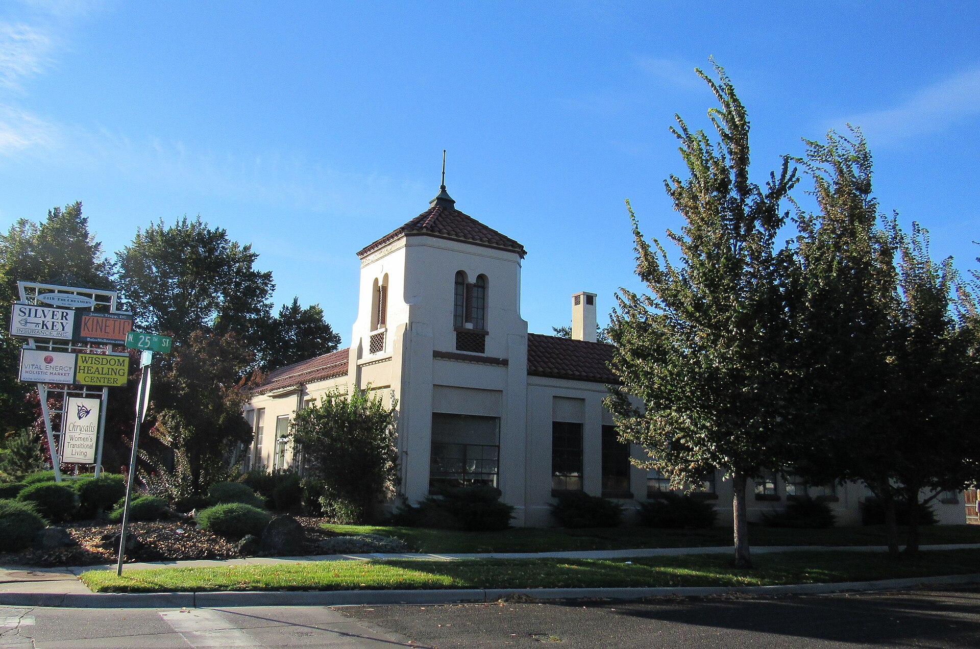
The Bench is the broad, elevated terrace south and west of downtown, cut off from the river valley by a visible escarpment. It is older than the newest suburbs but built at lower density than the North End — a mix of mid-century houses, strip commercial along arterial streets, and pockets of newer infill. The Central Bench sits closest to downtown and the Boise State University campus; East Boise and Southeast Boise extend the pattern toward the foothills and the river on the city’s eastern edge.
Because the Bench sits above the valley floor, several streets require a climb up from downtown, and older residents and city planning documents both use “the Bench” as shorthand for that geographic fact as much as for any social identity.
What is Depot Bench, and why is it named that?
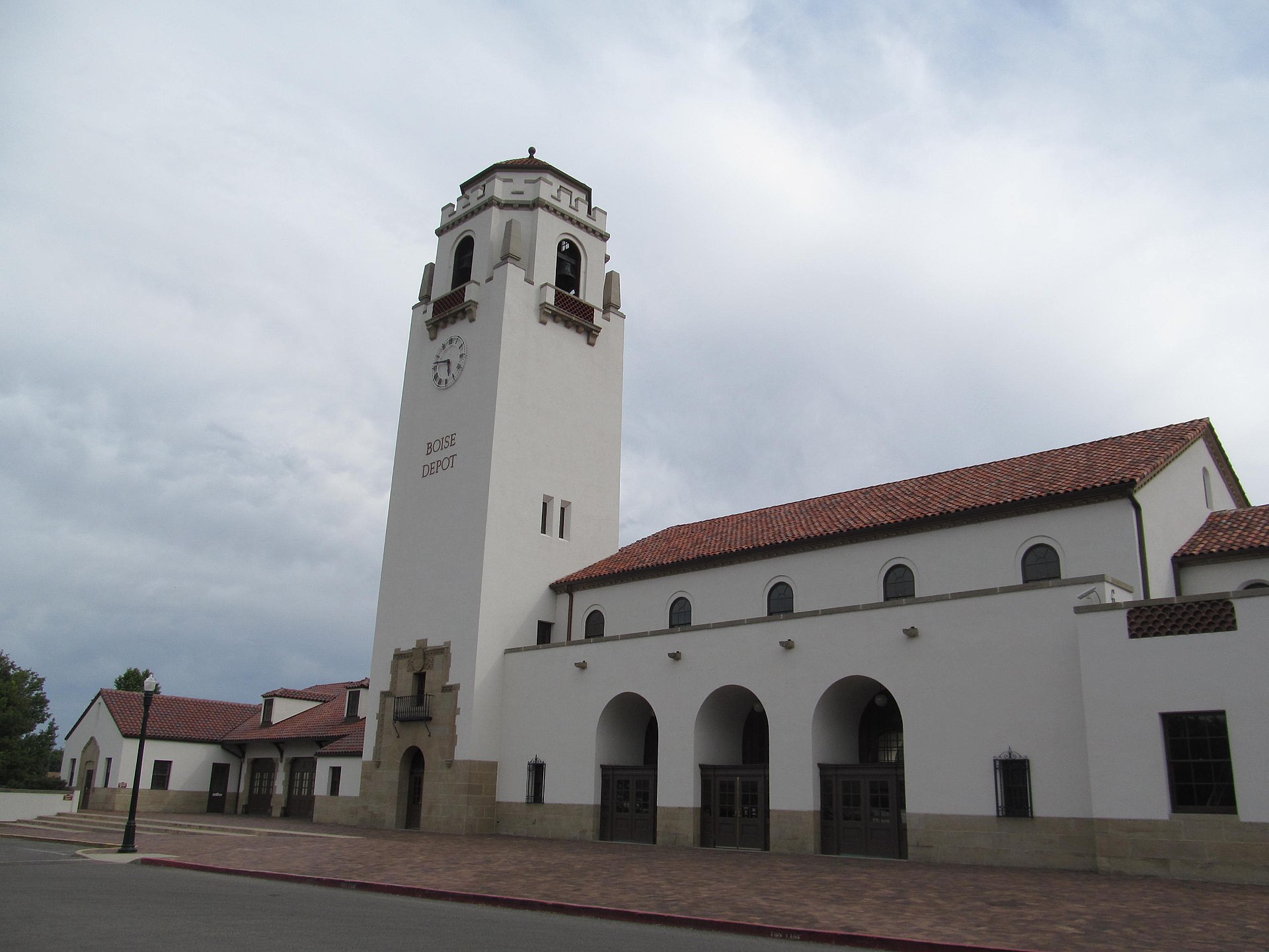
Depot Bench takes its name from the Boise Depot, the former Union Pacific train station that still stands above the Bench escarpment on Vista Avenue, now used for events and tours rather than active rail service. The neighbourhood around it combines older bungalow-style housing with the commercial strip along Vista Avenue, and its elevation gives it a clear line of sight down into the downtown grid.
What is West Boise like to live in?
West Boise is the newer, lower-density growth corridor between the older city grid and the border with Meridian. Housing here is predominantly built after 1980, laid out in subdivisions rather than a street grid, and organised around arterial roads rather than a walkable commercial spine. Big-box retail, chain restaurants, and newer schools cluster along Fairview Avenue and Overland Road.
Living in West Boise generally assumes a car. It sits farther from the Greenbelt and the foothills trailheads than the North End or the Bench, though it is closer to the Boise Airport than most of the rest of the city.
What is Southeast Boise like, and what is Bown Crossing?
Southeast Boise runs along the river toward Barber Park, mixing older river-adjacent housing with newer development pushed up against the foothills. Bown Crossing, near the intersection of Boise Avenue and Broadway, is a smaller, mixed-use commercial node within Southeast Boise — a deliberately walkable strip of shops and restaurants built to give that part of the Bench something closer to a neighbourhood centre, rather than a historic district in its own right.
Southeast Boise’s proximity to Barber Park matters practically: it is the standard put-in point for floating the Boise River in summer, and the neighbourhood absorbs the seasonal traffic that brings.
How does the foothills edge shape the neighbourhoods next to it?
Neighbourhoods that back directly onto the foothills — much of the North End, parts of East Boise, and the streets nearest Camel’s Back and Hulls Gulch — live with a set of rules that flatter suburbs never encounter. The city’s own Ridge to Rivers programme manages seasonal trail closures on the foothills’ clay-heavy soil, meaning access to the trail system directly behind these homes changes with the weather rather than staying fixed year-round. It also means homes at the foothills’ edge face wildfire exposure that the city and Idaho agencies address through defensible-space guidance rather than blanket assurance.
How do the surrounding suburbs compare to Boise’s own neighbourhoods?
Eagle, Meridian, Nampa, Caldwell, and Kuna are independent cities in the Treasure Valley, not Boise neighbourhoods, though commuting patterns blur the line for many residents. Eagle has grown fastest immediately northwest of Boise; Meridian anchors a large share of the valley’s newer retail and housing; Nampa and Caldwell are older agricultural towns absorbing their own growth farther west. Each functions with its own city government, schools, and downtown, distinct from Boise’s.
- Readers weighing Eagle against Boise proper can see the distinction laid out at What Is Eagle, Idaho? Boise’s Fast-Growing Suburb.
- Nampa’s separate identity and downtown are covered at What Is Nampa, Idaho? Boise’s Neighbor, Explained.
- Caldwell’s recent downtown changes are explained at What Is Caldwell, Idaho, and What Changed Downtown?.
Which Boise neighbourhoods work without a car?
Downtown, the North End, and parts of the East End are the only areas where daily life realistically works without one, given the density of the street grid and proximity to the Greenbelt. The Bench, West Boise, and the outer suburbs assume car ownership, with bus service from Valley Regional Transit filling gaps rather than replacing the car for most trips.
The broader mechanics of getting around — the street grid’s odd angles, where the connector ends, and how far apart things actually are — are covered in the Getting Around archive, including a direct answer at Do You Need a Car in Boise?.
Where to read more about specific districts
This overview stays broad by design. Deeper detail on individual districts — the Bench’s history, West Boise’s growth pattern, the difference between Boise, Meridian, and Eagle — sits in the site’s Neighbourhoods archive. Readers building a wider picture of daily life in the city, including housing cost and climate, can start at the Living in Boise hub, and those planning visits around specific districts can cross-reference the Boise Guide hub for landmarks tied to each one.
Access Boise is an independent guide written from published, checkable sources. We have not visited the places described here and we do not publish personal recommendations or invented ‘local favourites’ — where something is singled out as notable, we say who says so. Opening times, fares, closures and prices change at short notice, so treat everything here as a starting point and confirm with the museum, operator or venue directly before building a day around it. We give no advice on visas, insurance, health or safety; use your own government’s official guidance for those.
Featured image: Photo by Doug Kerr from Albany, NY, United States, source, CC BY-SA 2.0
.jpg)